5 Chronology
Here are my snapshots in the order I took them.
5.1 Mahaffie Farmstead
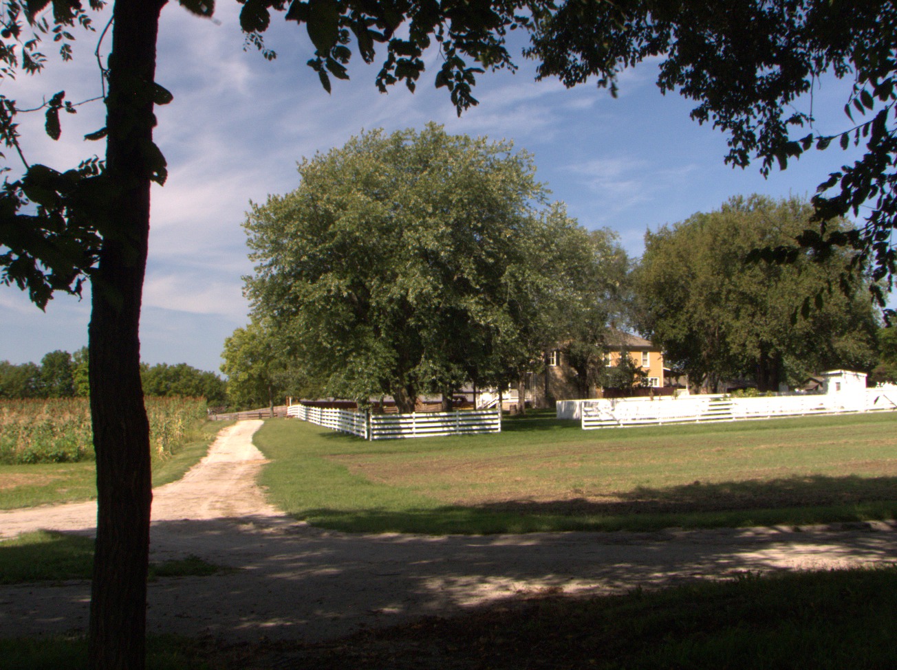
Mahaffie Farmstead -- This home, built in 1865, was a stagecoach station on the Santa Fe Trail. Now it is a park operated by the city of Olathe, KS. (Thu 03 Sep 2015 11:04AM, Fullsize 379KB, Map) |

Stagecoach -- "The Barlow and Sanderson Stagecoach Line contracted with the Mahaffie family to provide one of the stops needed for their coaches, running between Fort Scott and Fort Leavenworth, and carrying passengers and the U.S. Mail from Independence, Missouri, all the way to Santa Fe. By 1865 and until 1869, hungry passengers took their meals in the basement of the stone farmhouse, built to serve as a kitchen and dining hall. In 1867, Lucinda, her daughters, and hired helpers might have served as many as 50 to 100 meals a day. While the passengers ate, the incoming teams of horses were switched for fresh animals (Olathe Parks and Recreation, About)." It's doubtful that the stagecoach was originally equipped with drum brakes. (Thu 03 Sep 2015 11:39AM, Fullsize 444KB, Map) |
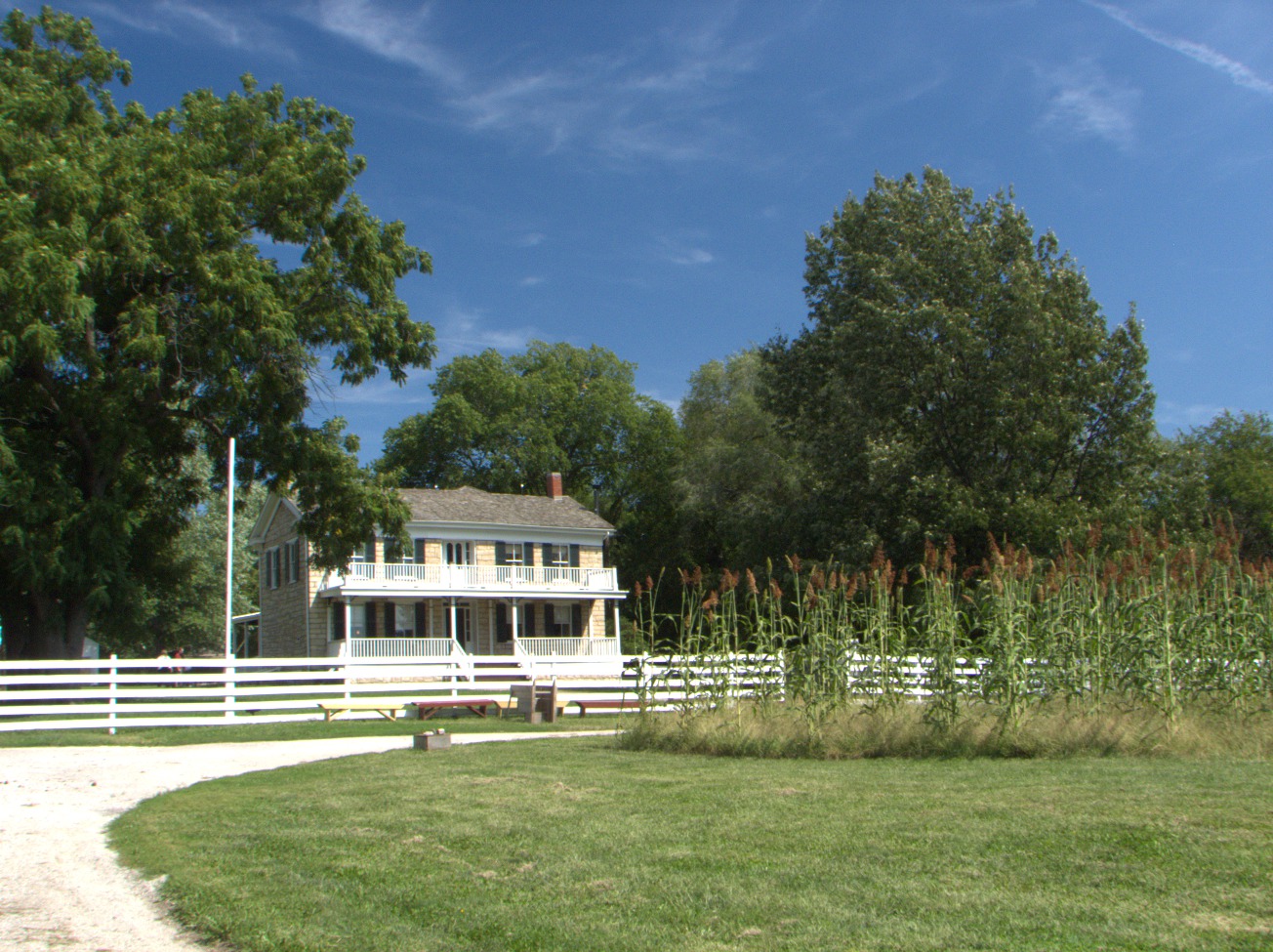
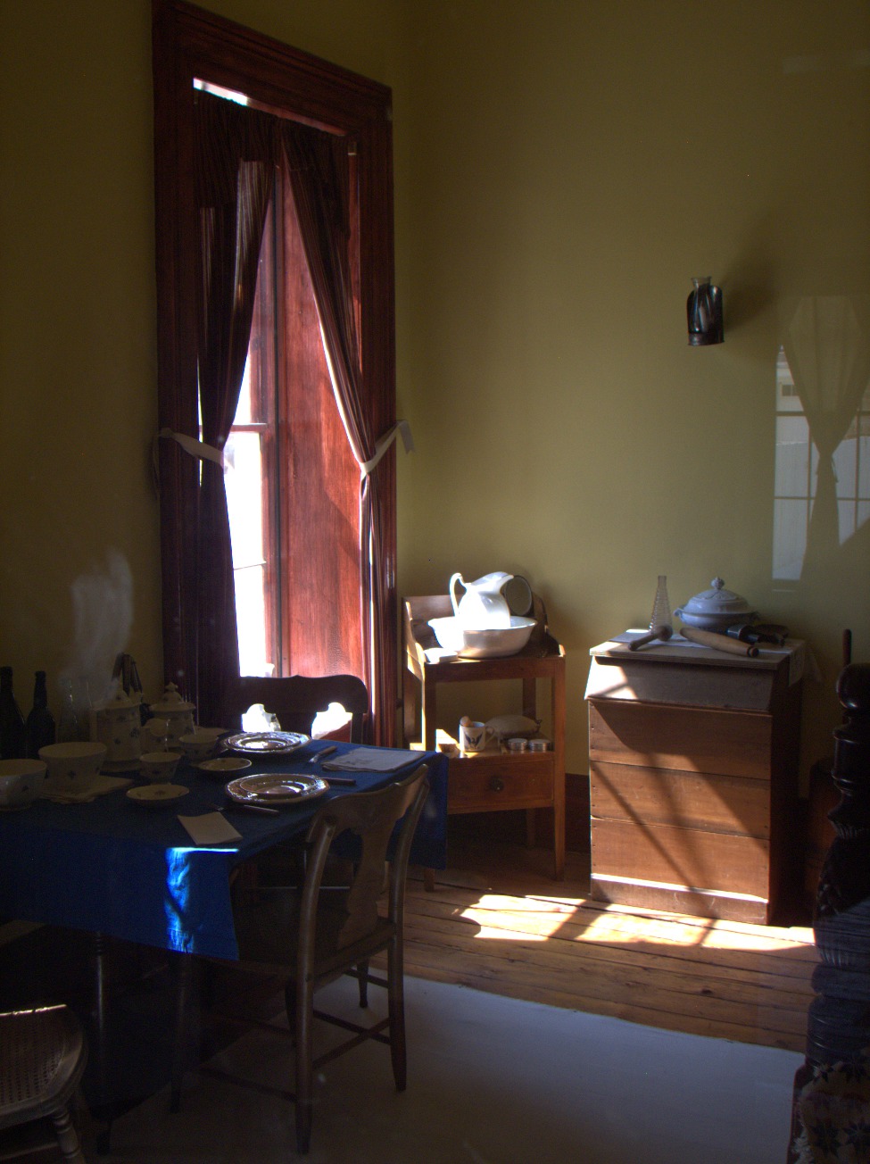
Mahaffie Farmstead -- The farm was a vertically integrated operation. The owners cared for draft animals used by the stagecoach line. Feed and forage were raised onsite. They provided meals for stagecoach passengers and crew and grew, slaughtered, and preserved that food themselves. (Thu 03 Sep 2015 11:49AM, Fullsize 393KB, Map) |
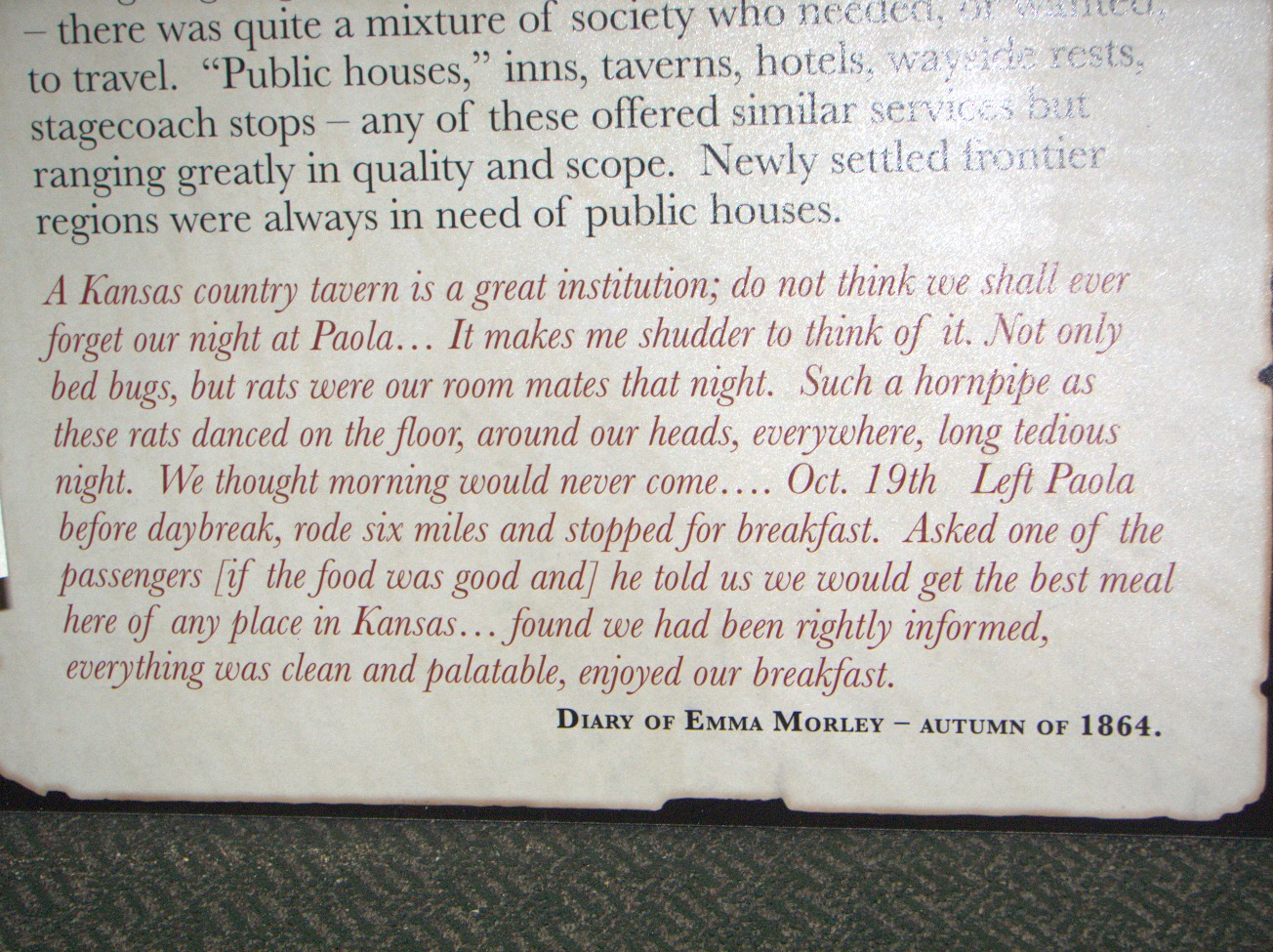
"... there was quite a mixture of society who needed, or wanted, to travel. 'Public houses,' inns, taverns, hotels, wayside rests, stagecoach stops -- any of these offered similar services, but ranging greatly in quality and scope. Newly settled frontier regions were always in need of public houses." From the diary of Emma Morley -- Autumn of 1864: "A Kansas country tavern is a great institution; do not think we shall ever forget our night at Paola.... It makes me shudder to think of it. Not only bed bugs but rats were our roommates that night. Such a hornpipe as these rats danced on the floor, around our heads, everywhere! Long tedious night -- we thought morning would never come.... Oct 19th. Left Paola before daybreak, rode six miles, and stopped for breakfast. Asked one of the passengers ... he told us we would get the best meal here of any place in Kansas.... Found we had been rightly informed. Everything was clean and palatable. Enjoyed our breakfast." (Thu 03 Sep 2015 11:55AM, Fullsize 483KB, Map) |
5.2 Santa Fe Trail Center
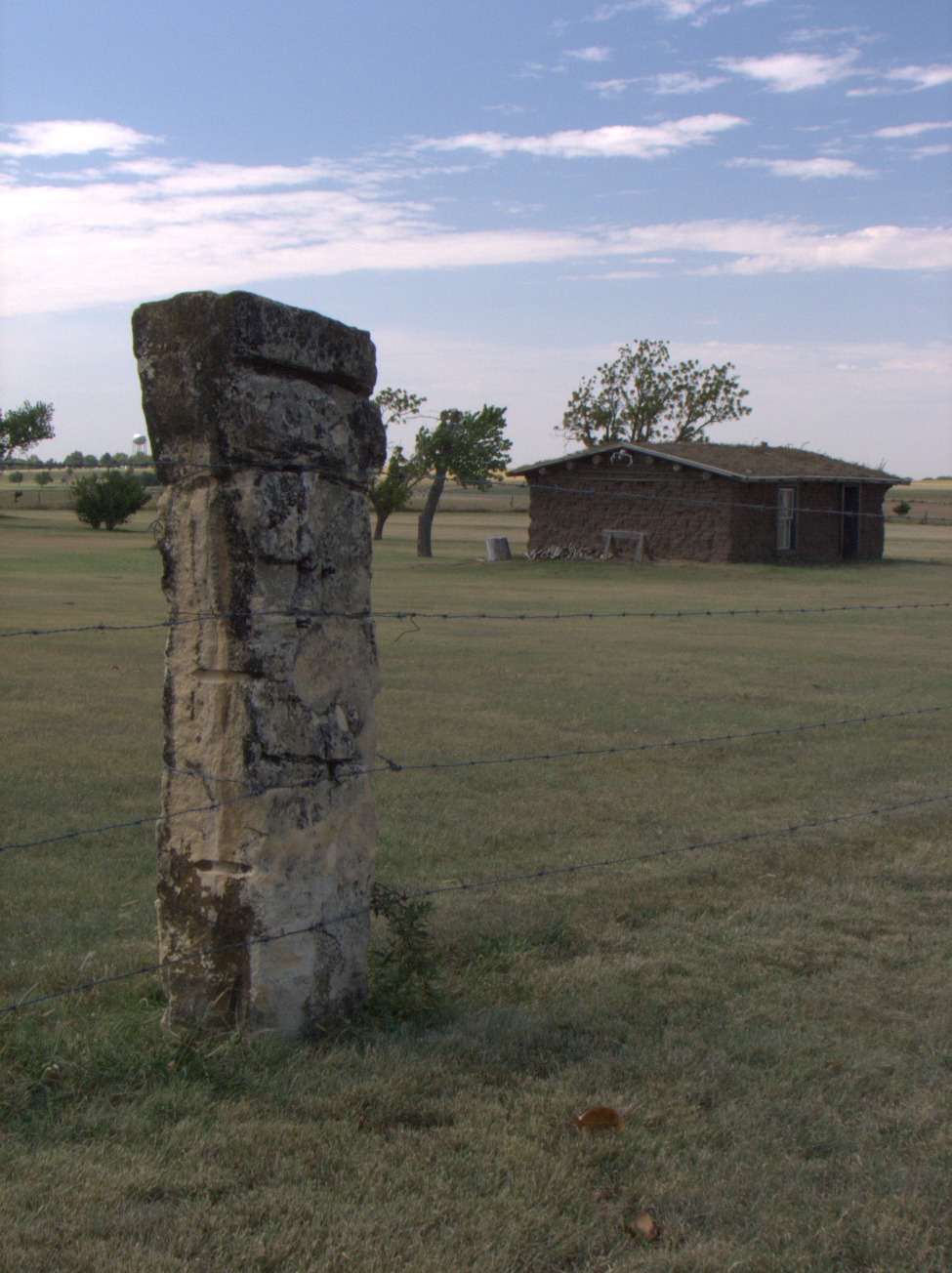
Soddy and Stone Fence Post -- Timber is scarce in Kansas. Nowadays one can run down to the nearest hardware and buy imported boards, but, during the heyday of the Santa Fe Trail, homesteaders usually made do with indigenous materials that were more affordable. This is a reproduction of a soddy, a shack built of turf skived off the prairie and stacked for walls. It may be seen at the Santa Fe Trail Center near Larned, KS. Wooden fence posts were few and far between, too. Where necessary, farmers substituted blocks of roughly quarried stone. (Fri 04 Sep 2015 12:27PM, Fullsize 293KB, Map) |

Disc Plow -- These farm implements were not so common as moldboard plows used in the Midwest. Their disadvantage is that they don't turn over last-year's vegetation as thoroughly as moldboard plows do. In dry-land farming this becomes an advantage because the unburied trash helps reduce wind erosion. Also, their repeated use is less likely to produce hardpan (Wikipedia, Plough). (Fri 04 Sep 2015 12:38PM, Fullsize 327KB, Map) |
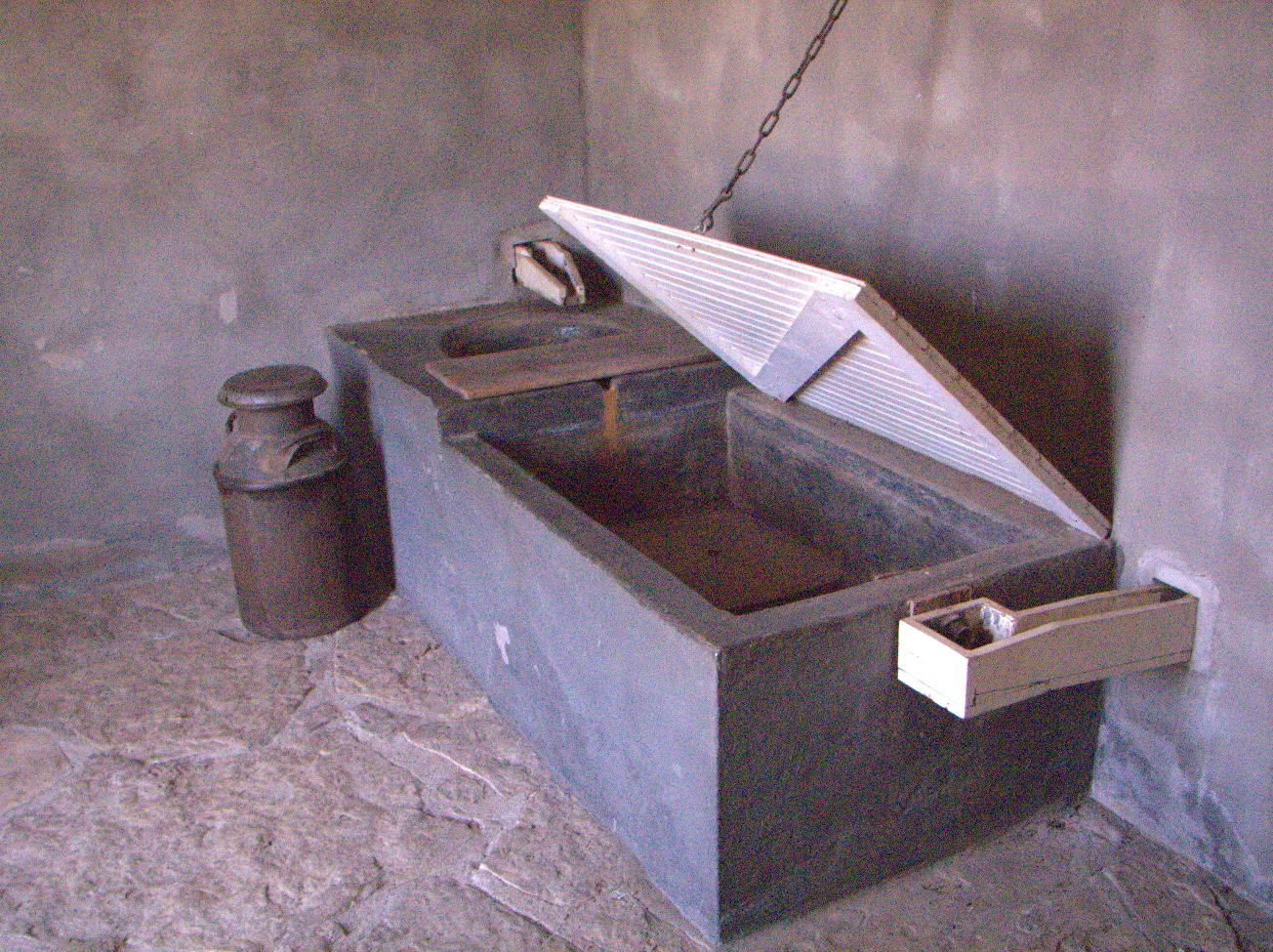
Milk Cooler -- Here is a well-insulated room with a floor below ground level. Outside, a windmill continuously pumps cool groundwater through a tank inside. Milk cans are immersed in the tank to cool the warm milk fresh from the cows before it goes sour and curdles, which works fine so long as the wind is blowing, which it mostly always does, I guess. Anyway, it was blowing well enough while I was there, but the windmill's brake was set. Probably, they don't like to have a mudhole outside, and they didn't have any fresh milk, either. I don't know whether it was customary to let the water run all day or not. I imagine that the oldtimers let it run long enough to bring the temperature of the milk down to the temperature of the groundwater and then set the brake. (Fri 04 Sep 2015 12:46PM, Fullsize 659KB, Map) |

L'Dora Schoolhouse -- This 1906 building was moved from Frizell, KS. The TV show Gunsmoke was set in Dodge City, KS, in the late 1880s. It ran from 1955 to 1975 and was the U.S. market's longest-running prime-time live-action drama (Wikipedia, Gunsmoke). Milburn Stone played Doc Adams during the whole run. His family lived for a time in Frizell, and he went to school in this building. (Fri 04 Sep 2015 12:56PM, Fullsize 282KB, Map) |

Case Eagle -- A bald eagle, "Old Abe," was the trademark of the J. I. Case Company. These cast iron effigies were installed at farm-implement dealerships. (Fri 04 Sep 2015 01:05PM, Fullsize 470KB, Map) |
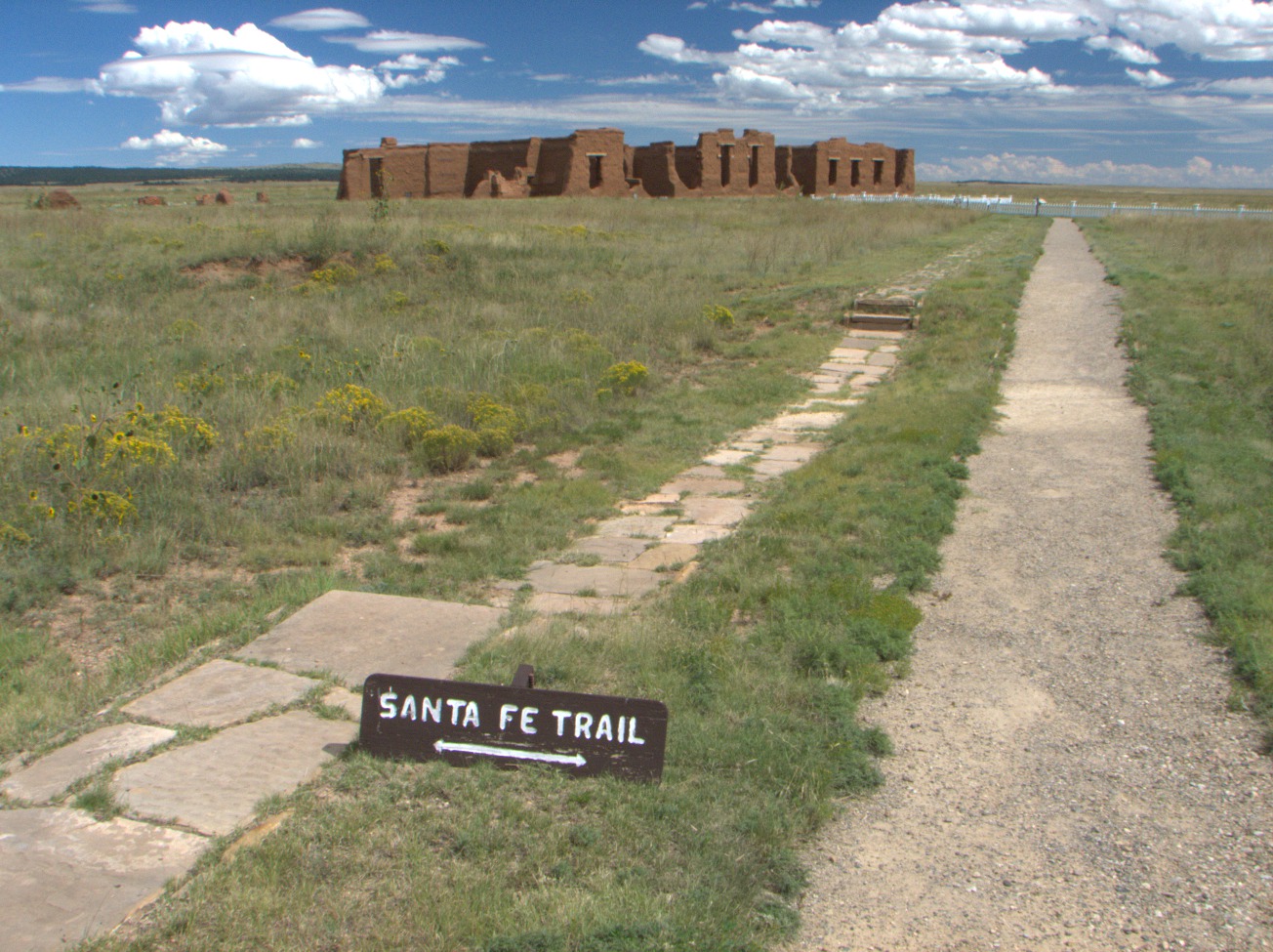
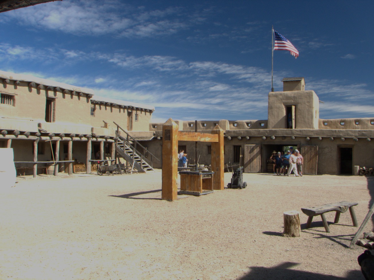
5.3 Fort Larned
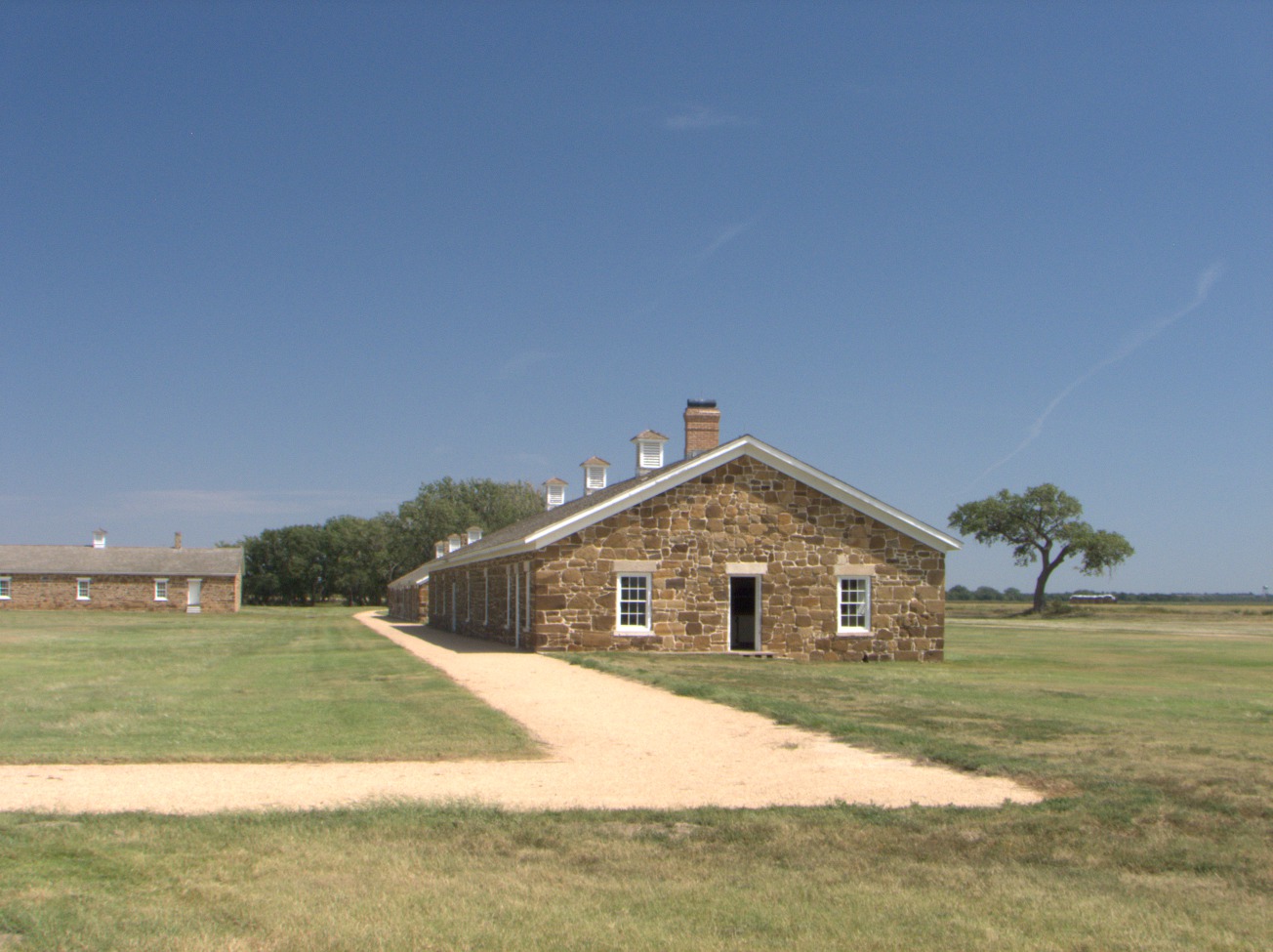
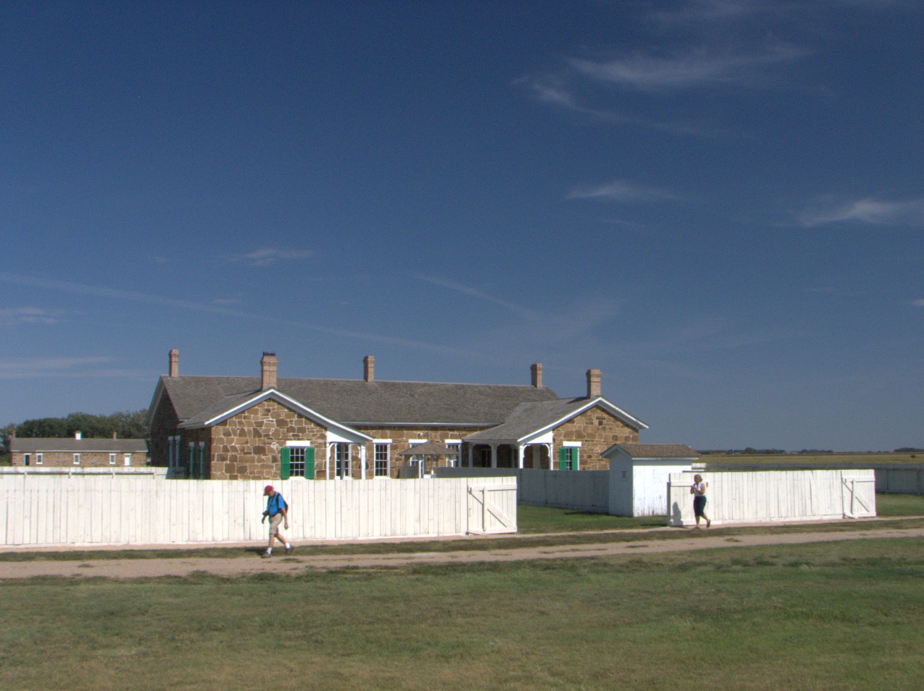
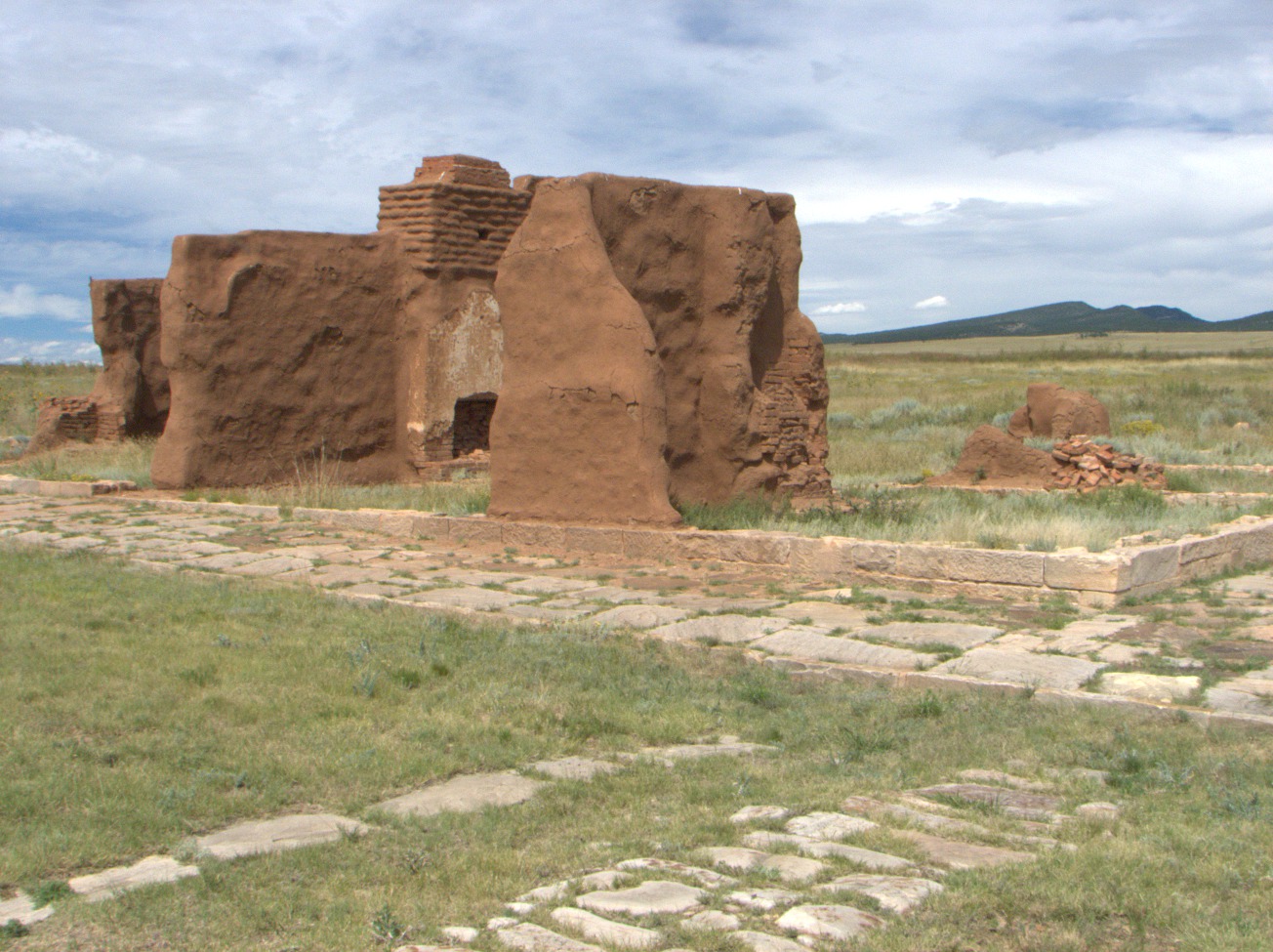
Stone Buildings -- The stone buildings at Fort Larned are original, although they have been extensively renovated in the last fifty years. They were built between 1866 and 1868 (U.S. National Park Service, Fort Larned's Buildings). Other less permanent structures have not survived. The fort was decommissioned in 1878, and the property was sold in 1884 (U.S. National Park Service, Watching the Fort). It was a ranch until 1966 when it passed back into federal ownership. The Frizell family operated the ranch after 1902 (U.S. National Park Service, Ranching Period) and did not make any irrevocable architectural changes. (Fri 04 Sep 2015 01:54PM, Fullsize 242KB, Map) |
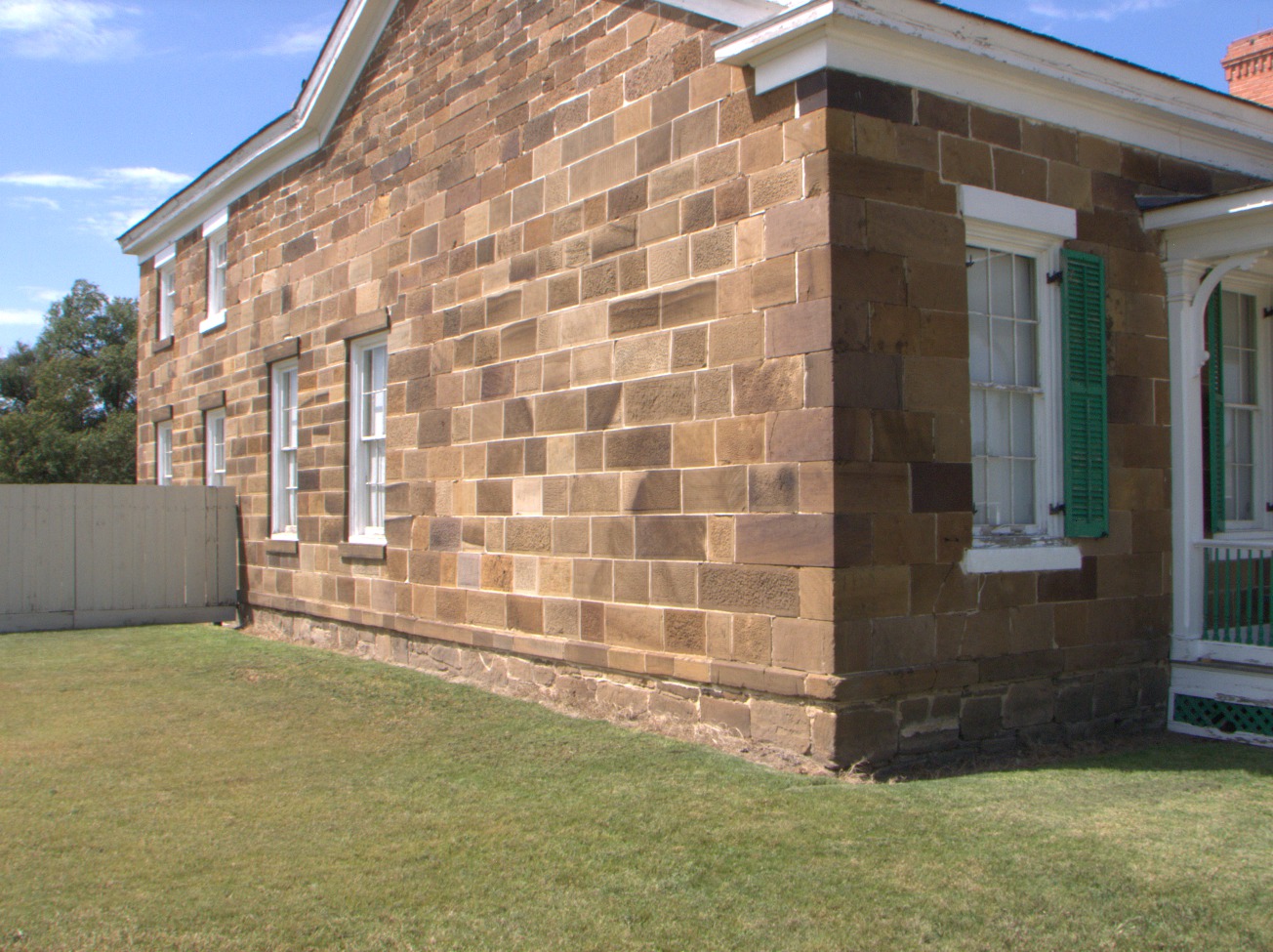
Fine Masonry -- Workmen who quarried the stone nearby and who mortared it into place here knew their business, took pride in their handicraft, and evidently spent too much time and effort on it to please their superiors. (Fri 04 Sep 2015 01:56PM, Fullsize 349KB, Map) |
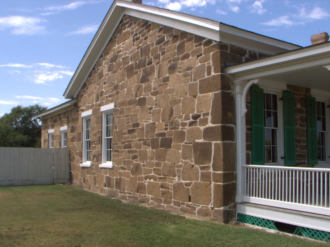
Rough Masonry -- You can easily imagine that those in charge concluded there was too much waste of material and time going on and commanded a more pragmatic standard of construction for the remaining buildings. (Fri 04 Sep 2015 01:57PM, Fullsize 327KB, Map) |
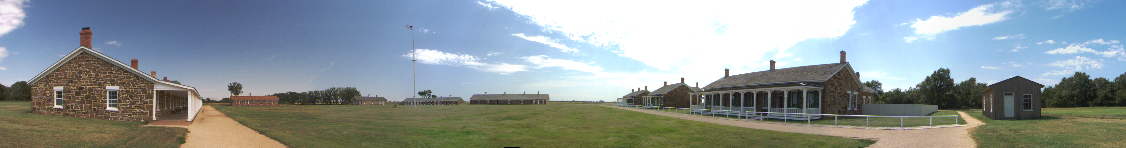
Panorama -- This thumbnail is number six out of ten that were stitched together using the Hugin utility program. Please click on the thumbnail to see a 180° panorama of the quadrangle. (Fri 04 Sep 2015 02:01PM, Fullsize 5.2MB, Map) |
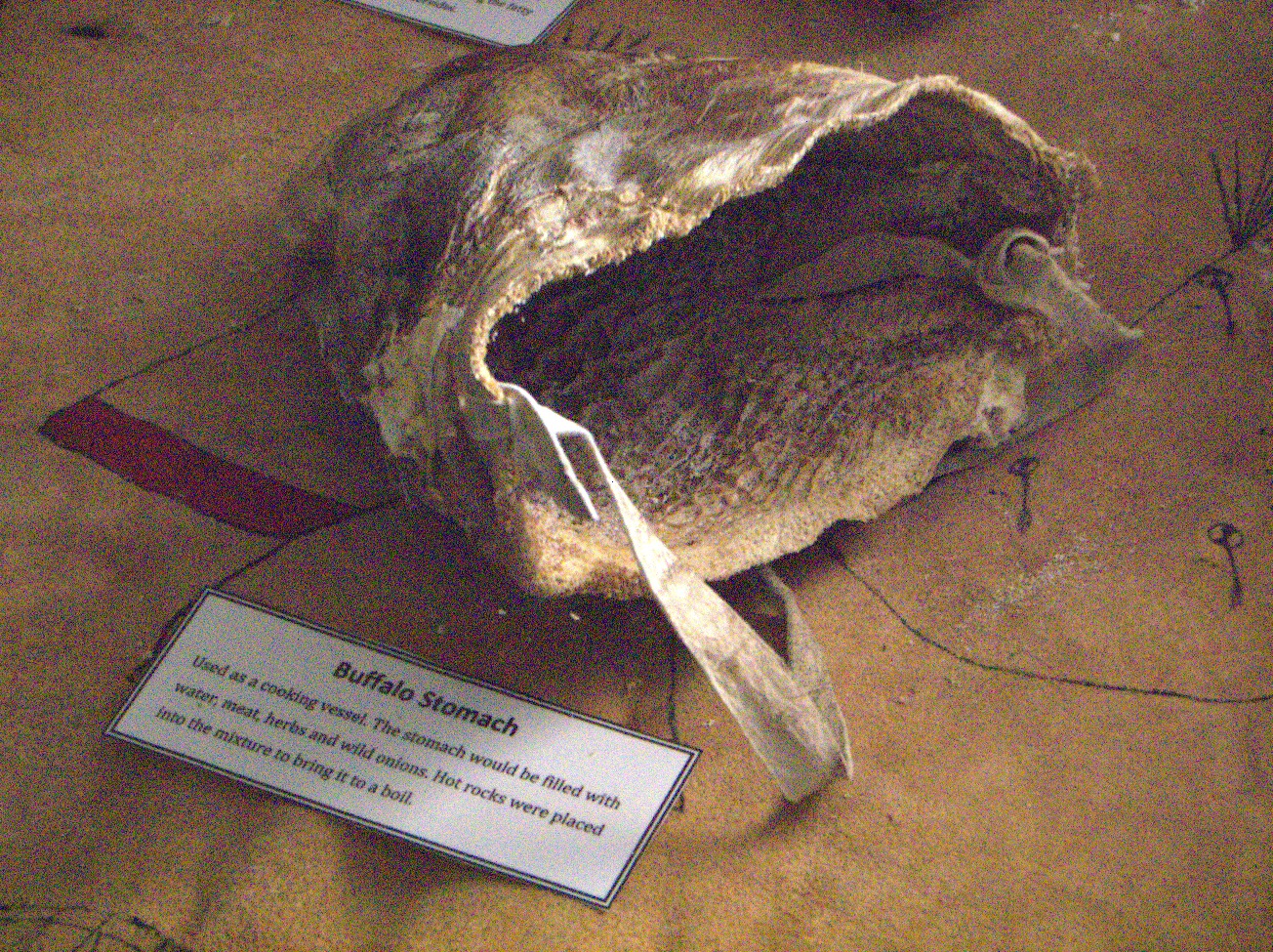
Buffalo Stomach -- "Used as a cooking vessel. The stomach would be filled with water, meat, herbs, and wild onions. Hot rocks were placed into the mixture to bring it to a boil." (Fri 04 Sep 2015 02:20PM, Fullsize 811KB, Map) |
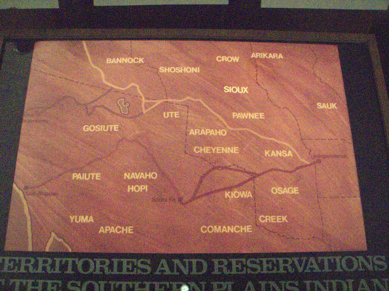
Territories and Reservations of the Southern Plains Indians. (Fri 04 Sep 2015 02:30PM, Fullsize 834KB, Map) |
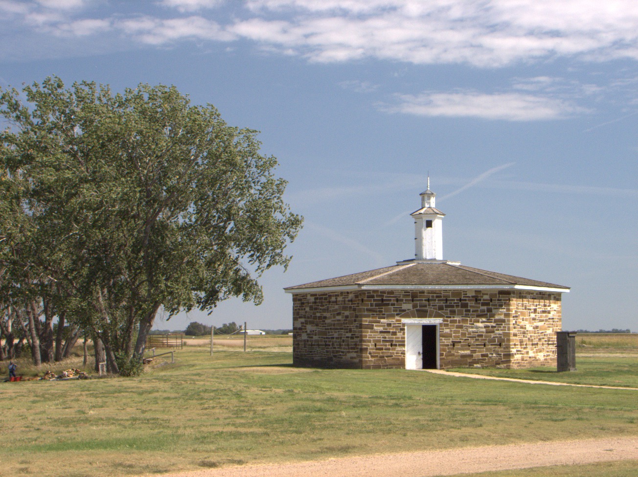
The Blockhouse was a fire-resistant storehouse for ammunition. There are loopholes in the walls for defense. Although it was located outside the quadrangle, it was designed as a citadel. There is a water well in the floor to enable defenders to withstand a siege (U.S. National Park Service, Blockhouse). (Fri 04 Sep 2015 03:10PM, Fullsize 368KB, Map) |
Interior -- Officers and their families lived in comparative comfort. (Fri 04 Sep 2015 03:36PM, Fullsize 228KB, Map) |
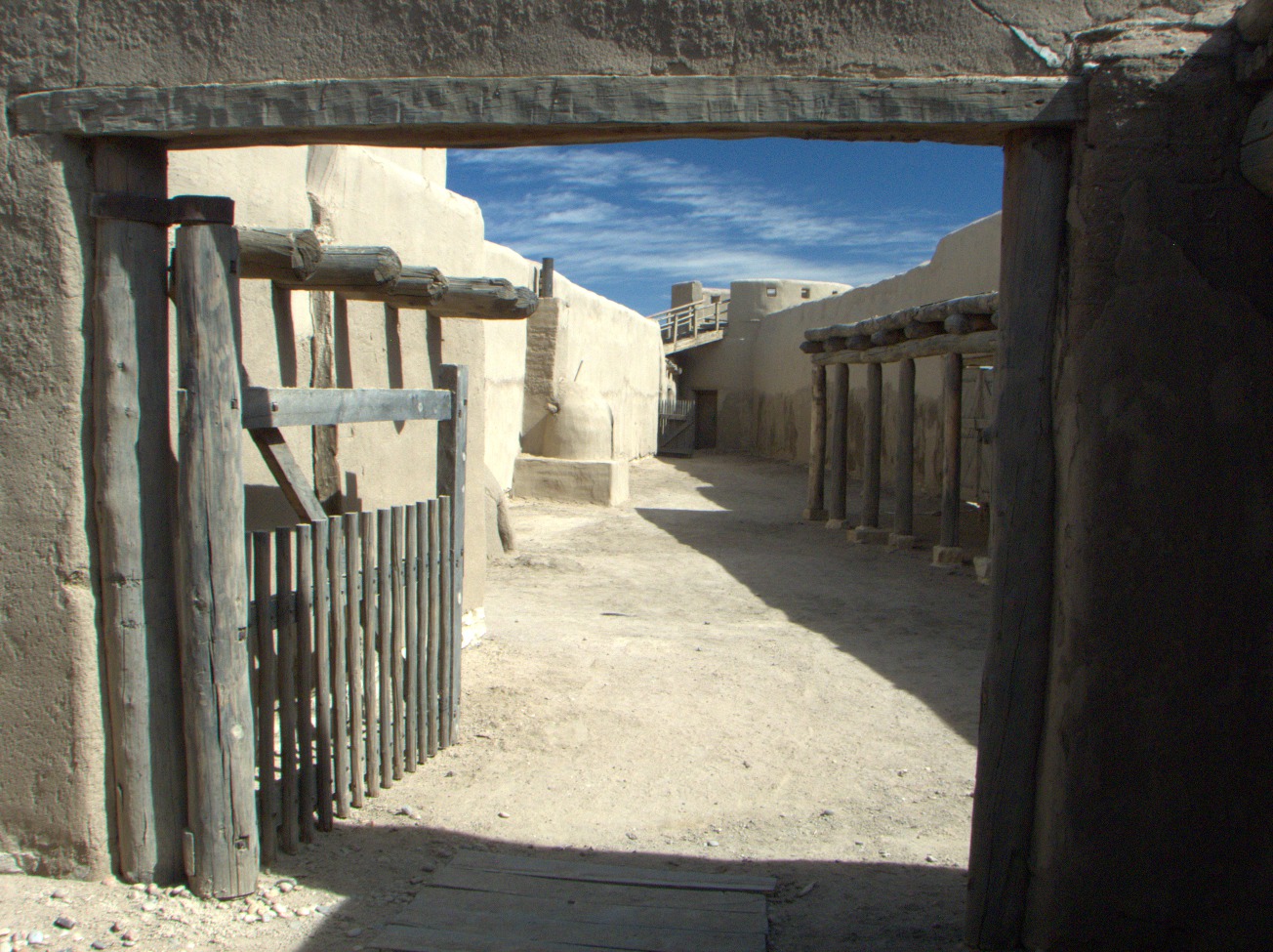
Wells and Privies -- Each duplex at the west side of the quadrangle had its own well and privy. They seem awfully close together by today's standards (Muruka). (Fri 04 Sep 2015 03:47PM, Fullsize 258KB, Map) |
5.4 Clayton
The Rabbits' Ears is a volcanic geological formation near Clayton, NM. (Sat 05 Sep 2015 01:53PM, Fullsize 298KB) |
The Rabbits' Ears is a volcanic geological formation near Clayton, NM. (Sat 05 Sep 2015 01:54PM, Fullsize 356KB) |
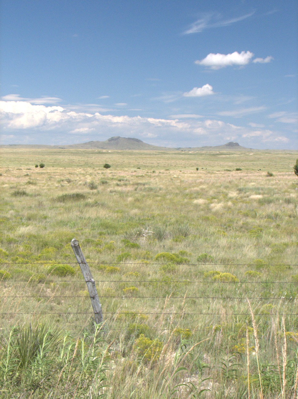
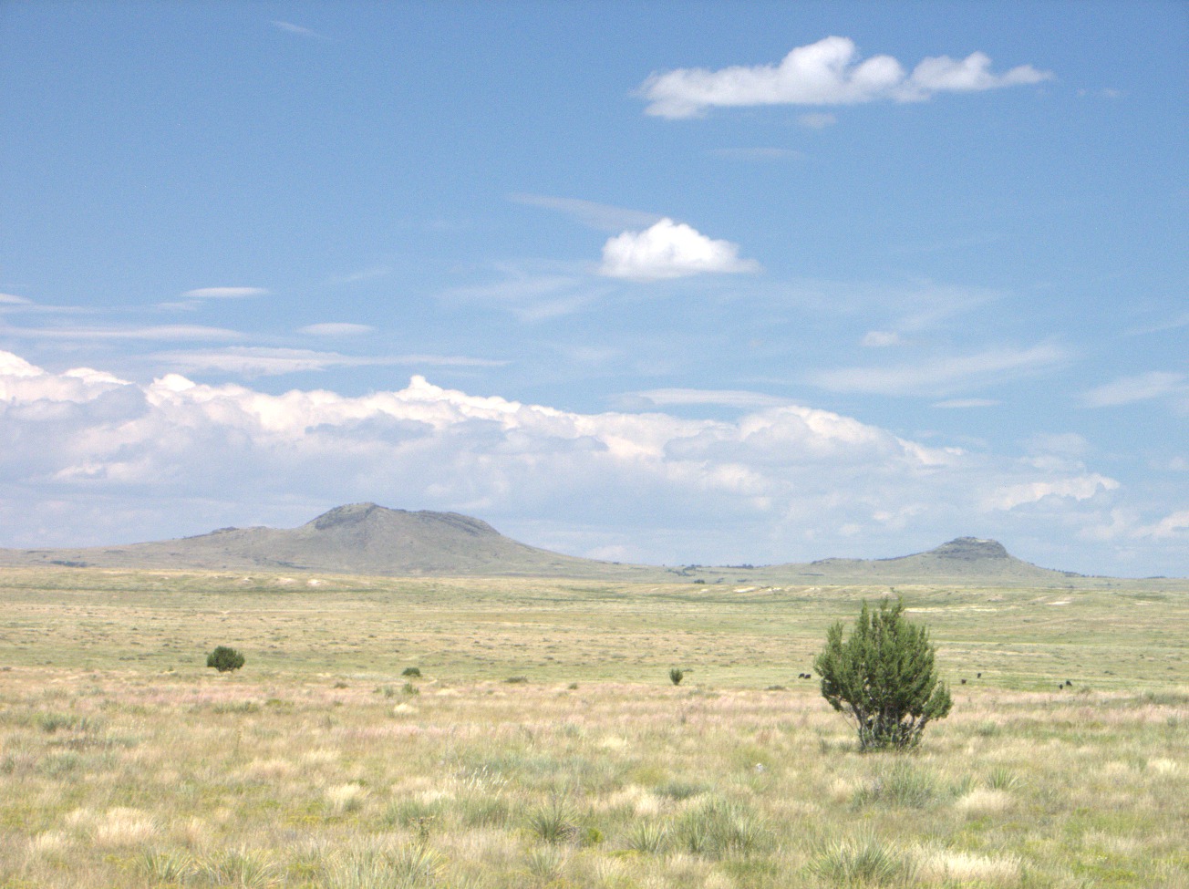
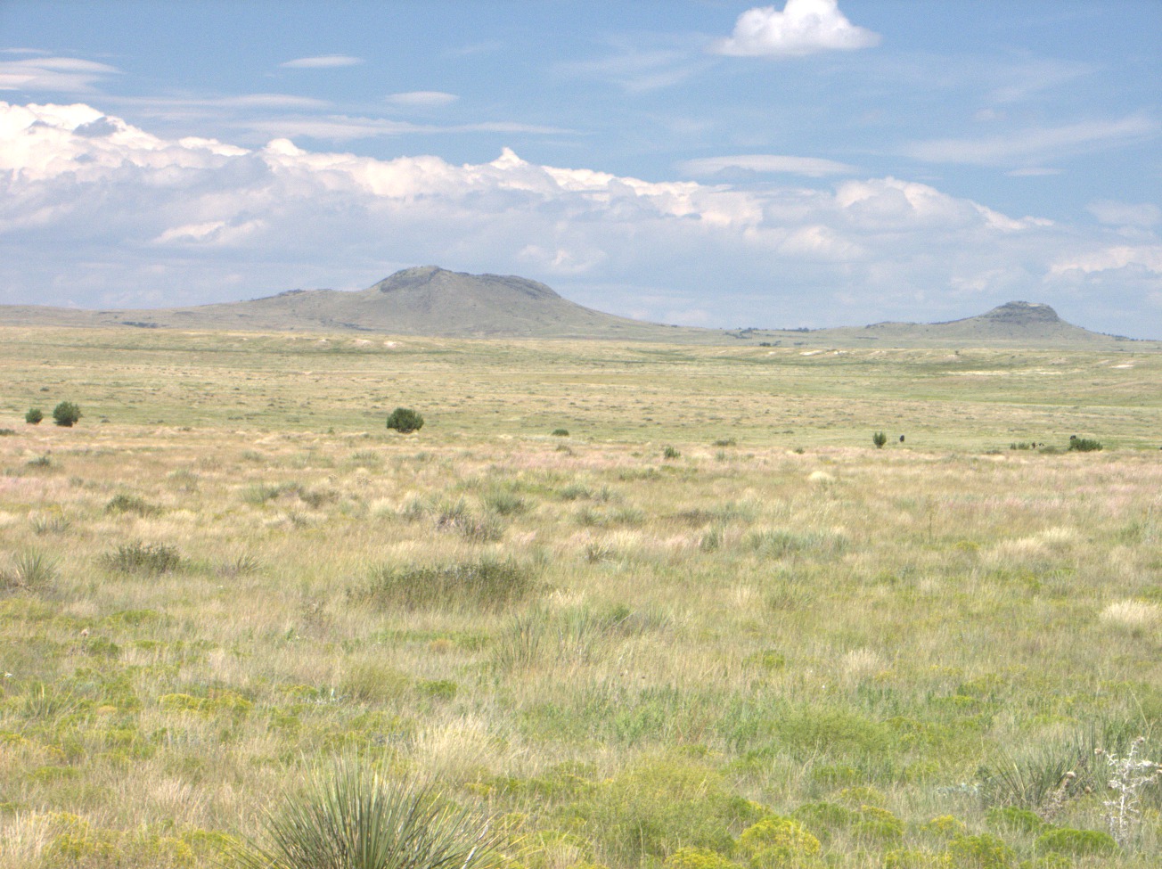
The Rabbits' Ears -- There are cinder cones of extinct volcanoes all over northern New Mexico. These near Clayton are called the Rabbits' Ears. The Spanish defeated the Comanches here in a great battle in the early 18th century (Clayton -- Union County Chamber of Commerce). The Spanish name of the Comanche leader was Orejas de Conejos, but, whether the chief was named for the mountains or vice versa, history cannot say (Flint). Perhaps from a certain direction and in a certain light these peaks resemble two rabbits perched on the plain with their ears laid back. What do you see? (Sat 05 Sep 2015 01:55PM, Fullsize 378KB) |
5.5 Springer
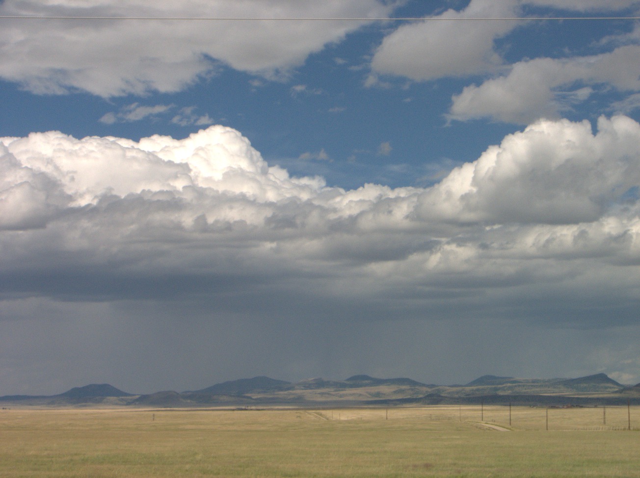
Virga -- There is a turnout on U.S. 56 near Point of Rocks, which is on the Santa Fe Trail. The turnout provides vistas of the surrounding land. This is the view to the north. The place is in the rain shadow of the Rocky Mountains. Westerly winds are lifted and cooled, and the rain falls on the high ground but not here (Wikipedia, Virga). (Sat 05 Sep 2015 02:58PM, Fullsize 213KB, Map) |

Rocky Mountains -- A turnout on U.S. 56 near Point of Rocks, NM, provides the first vista of the Sangre de Cristo Range of the Rocky Mountains. This is supposed to be similar to the view obtained by travelers from Missouri and Kansas along the Santa Fe Trail a few miles north of this spot. (Sat 05 Sep 2015 03:01PM, Fullsize 234KB, Map) |
5.6 Wagon Mound
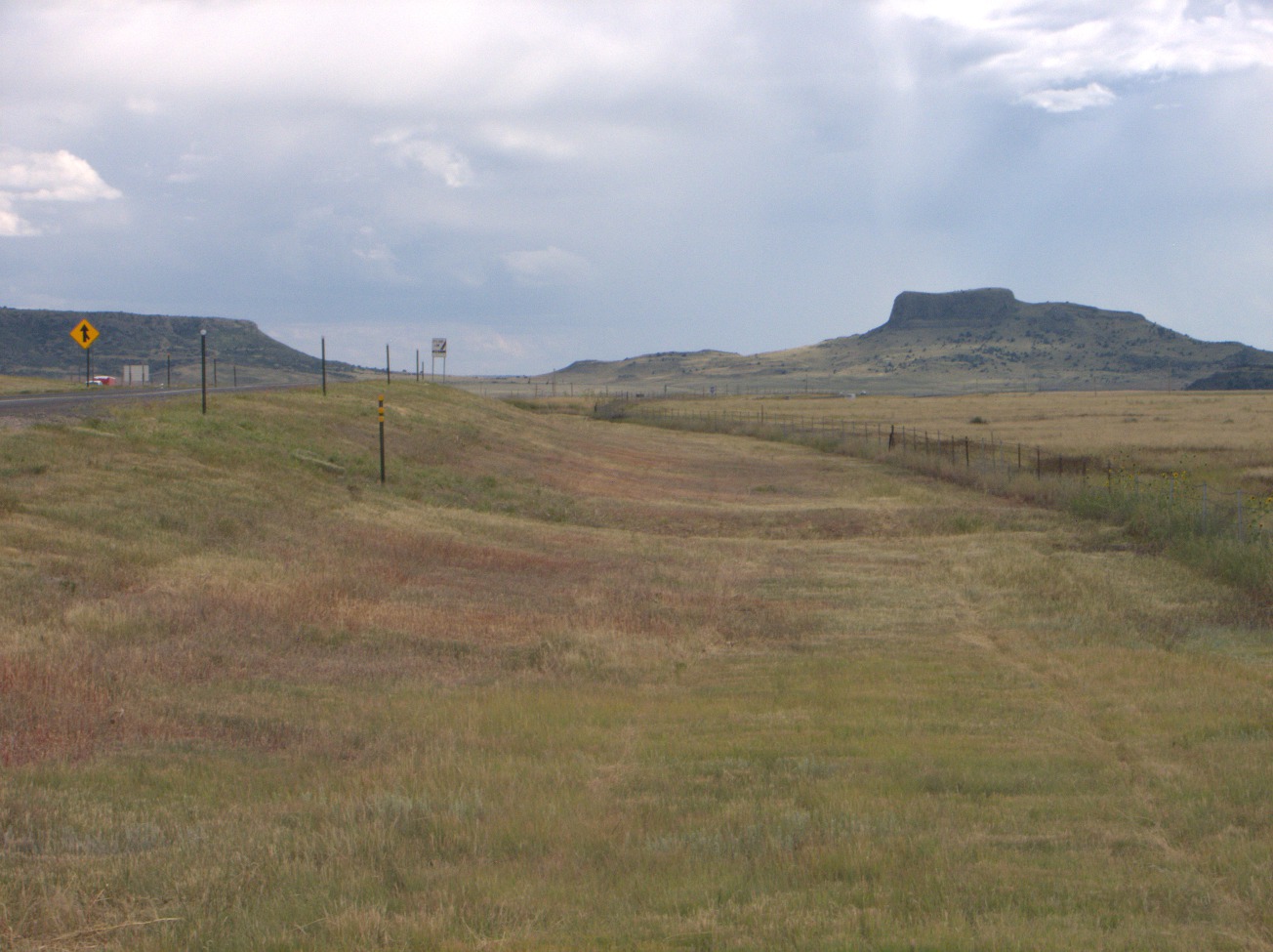
Wagon Mound, NM. (Sat 05 Sep 2015 04:35PM, Fullsize 258KB) |
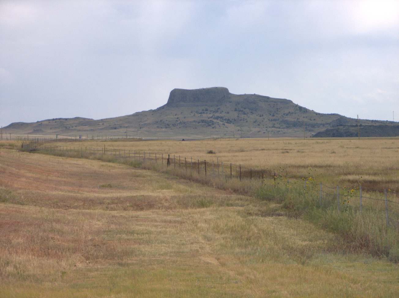
Wagon Mound -- This geological formation suggests the profile of a covered wagon drawn by oxen. It is a landmark on the Santa Fe Trail and gives its name to the nearby town on Interstate 25. (Sat 05 Sep 2015 04:35PM, Fullsize 265KB) |
5.7 Santa Fe
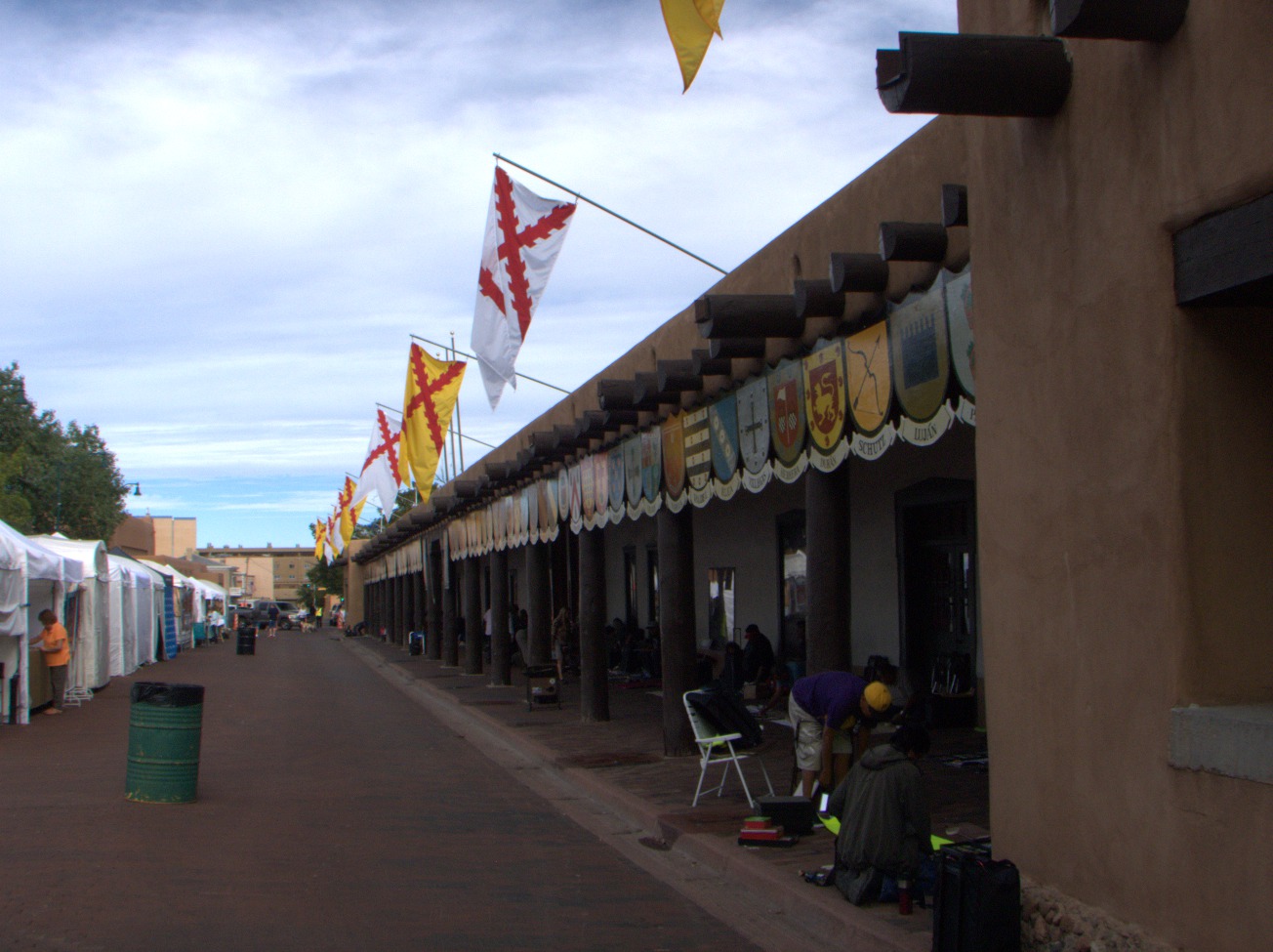
Palace of the Governors -- in Santa Fe, NM, is the oldest public building in continual use in the United States (U.S. National Park Service, Palace of the Governors). This adobe structure was erected in 1610. (Sun 06 Sep 2015 09:40AM, Fullsize 237KB, Map) |
5.8 Las Vegas
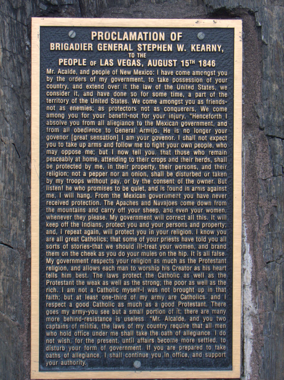
Proclamation -- This speech was delivered from the roof of a building on the plaza at Las Vegas, NM, by General Kearny on 15 August, 1846, during the Mexican-American War. He delivered the same proclamation in Santa Fe on 19 August. (Sun 06 Sep 2015 12:51PM, Fullsize 526KB) Proclamation of Brigadier General Stephen W. Kearny, To the People of Las Vegas, August 15th 1846 Mr. Alcalde, and people of New Mexico: I have come amongst you by the orders of my government, to take possession of your country, and extend over it the law of the United States, we consider it, and have done so for some time, a part of the territory of the United States. We come amongst you as friends -- not as enemies; as protectors not as conquerors. We come among you for your benefit -- not for your injury, "Henceforth I absolve you from all allegiance to the Mexican government, and from all obedience to General Armijo. He is no longer your governor [great sensation] I am your governor. I shall not expect you to take up arms and follow me to fight your own people, who may oppose me; but I now tell you, that those who remain peaceably at home, attending to their crops and their herds, shall be protected by me, in their property, their persons, and their religion; not a pepper nor an onion, shall be disturbed or taken by my troops without pay, or by the consent of the owner. But listen! he who promises to be quiet, and is found in arms against me, I will hang. From the Mexican government you have never received protection. The Apaches and Navajoes come down from the mountains and carry off your sheep, and even your women, whenever they please. My government will correct all this. It will keep off the Indians, protect you and your persons and property; and, I repeat again, will protect you in your religion. I know you are all great Catholics; that some of your priests have told you all sorts of stories -- that we should ill-treat your women, and brand them on the cheek as you do your mules on the hip. It is all false. My government respects your religion as much as the Protestant religion, and allows each man to worship his Creator as his heart tells him best. The laws protect the Catholic as well as the Protestant; the weak as well as the strong; the poor as well as the rich. I am not a Catholic myself -- I was not brought up in that faith; but at least one-third of my army are Catholics and I respect a good Catholic as much as a good Protestant. There goes my army -- you see but a small portion of it; there are many more behind -- resistance is useless. "Mr. Alcalde, and you two captains of militia, the laws of my country require that all men who hold office under me shall take the oath of allegiance I do not wish, for the present, until affairs become more settled, to disturb your form of government. If you are prepared to take oaths of allegiance, I shall continue you in office, and support your authority. |
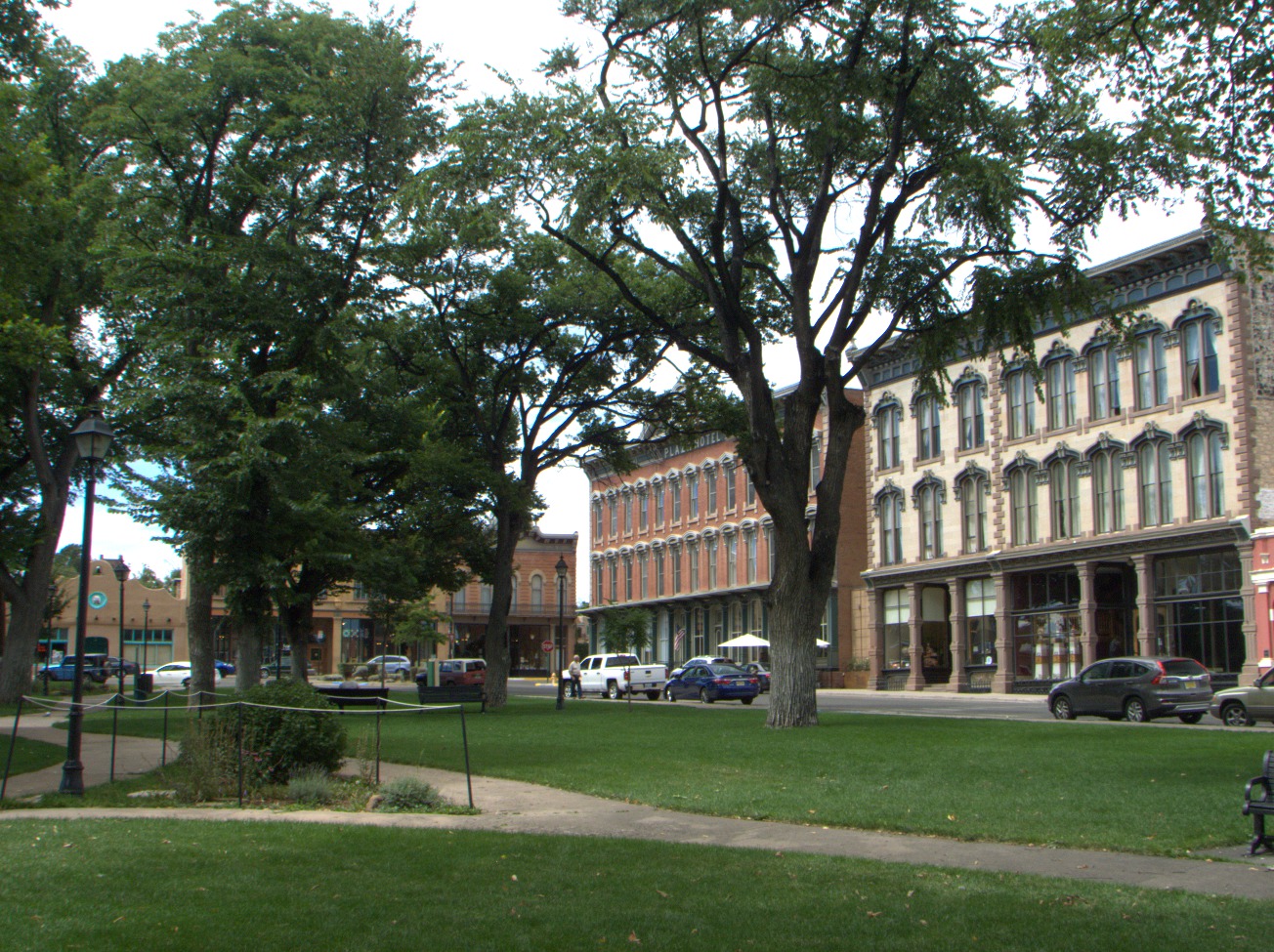
Plaza -- This is the town square of Las Vegas, NM. The tall, red-brick building in the background on the corner is the Plaza Hotel (1882). Some interior scenes for the Cohen Brothers' No Country for Old Men were filmed in the hotel (Paul), and the town has played host to other TV and movie crews as well, such as those for Netflix' Longmire . (Sun 06 Sep 2015 12:53PM, Fullsize 512KB) |
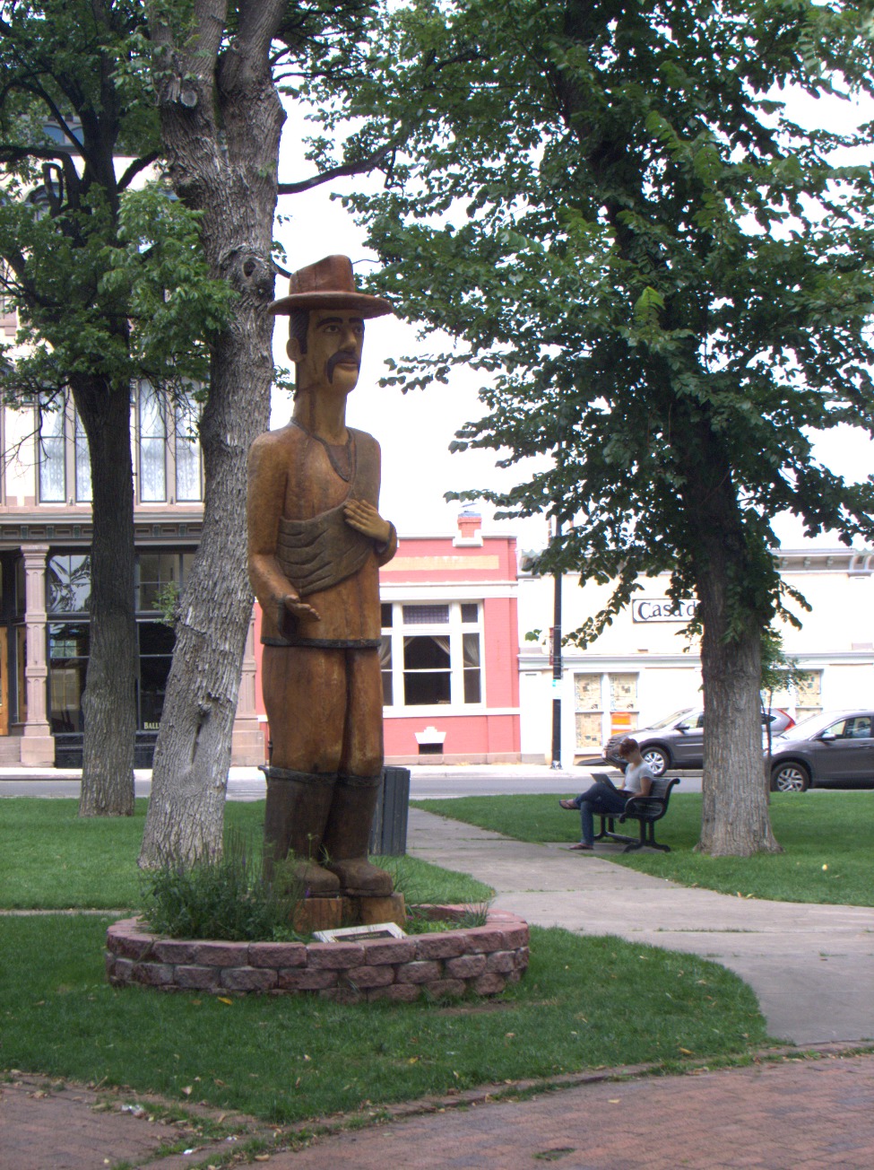
El campesino -- This is a wood sculpture completed in 2013 by Peter Lopez. It is installed in the plaza at Las Vegas, NM, and presides over the farmers' markets held there. (Sun 06 Sep 2015 12:56PM, Fullsize 468KB) |
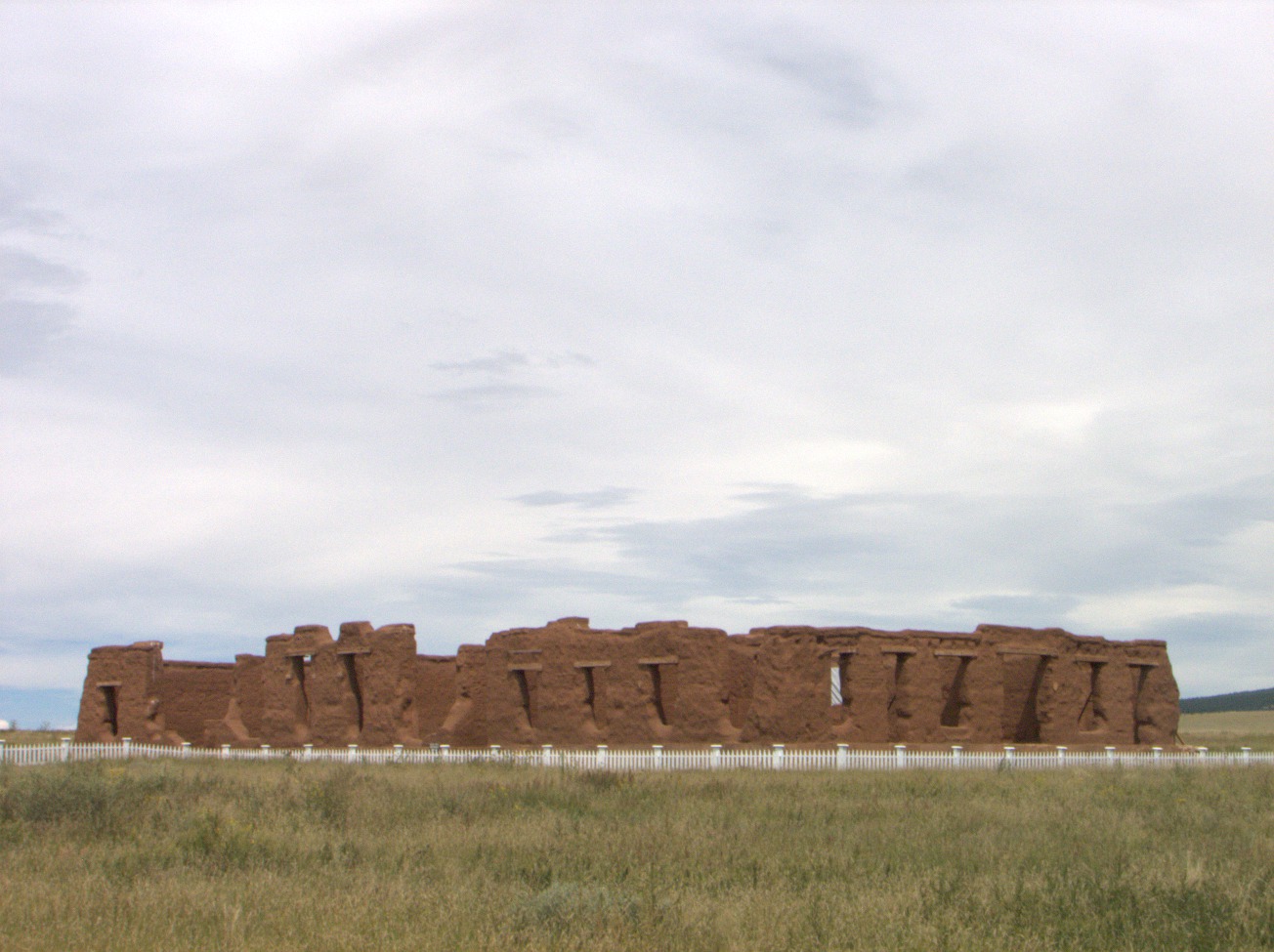
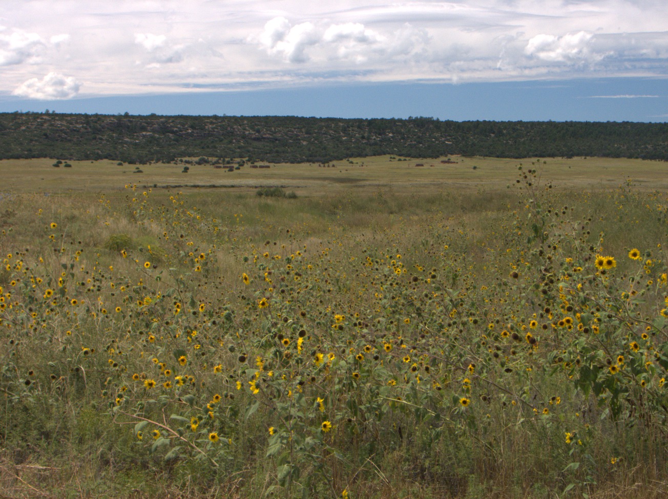
5.9 Fort Union
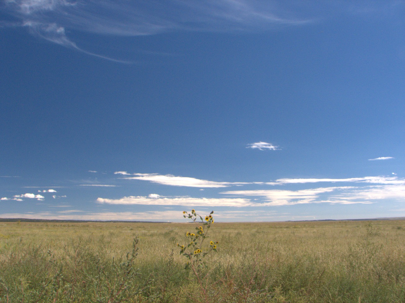
A Sunflower breaks the horizon at Fort Union, NM. (Sun 06 Sep 2015 02:09PM, Fullsize 283KB, Map) |
Hospital Ruins. (Sun 06 Sep 2015 02:09PM, Fullsize 246KB, Map) |
Civil War Earthworks -- Here is a ground-level view of defensive earthworks built during the Civil War. They were never used. Instead, Confederate forces were routed at Glorieta Pass (Wikipedia, Battle of Glorieta Pass) at the head of the canyon of the Pecos River near Santa Fe. An aerial view of the earthworks is more impressive. They are seen as a small eight-pointed star southwest of the quadrangle, which was built later. The original fort was located across the creek to the west but was vulnerable to cannon fire from higher ground there. In spite of expense and effort invested in their construction, the earthworks were, too. This was due to improvements in artillery unaccounted for during planning. (Sun 06 Sep 2015 03:03PM, Fullsize 384KB, Map) |

|

|
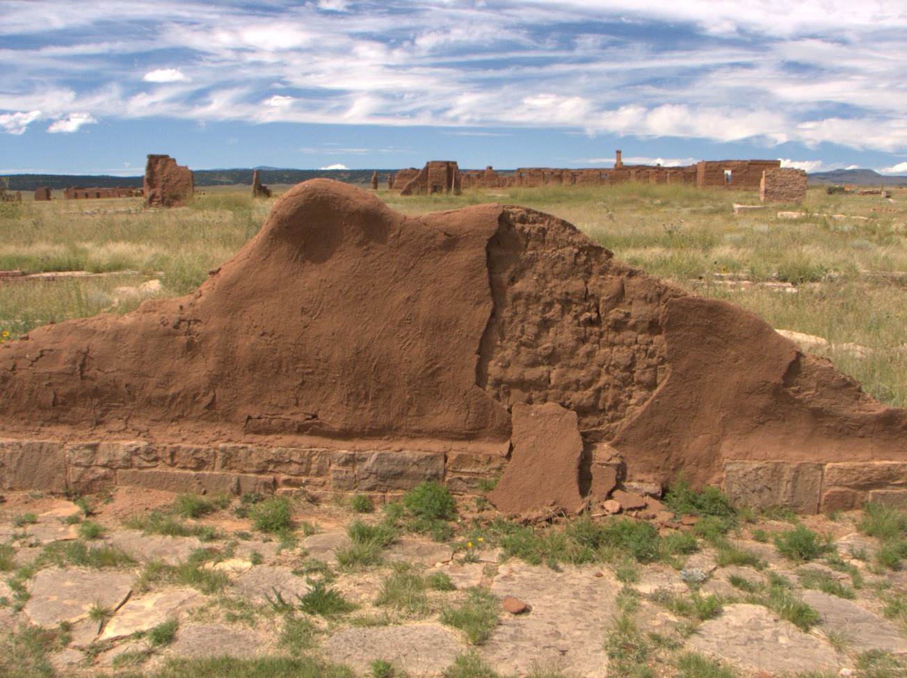
Stabilized Adobe-Wall Remnant -- Obviously the adobe ruins of Fort Union have not stood the test of time nearly so well as the stone buildings at Fort Larned or even the adobe walls of the Palace of the Governors in Santa Fe. This is because adobe is sun-baked brick. It is not fired: hence, it erodes in rain. Adobe structures require ongoing maintenance (Wikipedia, Adobe). Here you can see how the stucco, which has cracked away, should protect the adobe brick underneath. (Sun 06 Sep 2015 03:15PM, Fullsize 368KB, Map) |
|

Jail -- One of the functions of Fort Union was to extend U.S. federal law and order to New Mexico Territory and enforce it there. Doing this required cells where lawbreakers could be incarcerated. Obviously, desperados could dig their way right through an adobe wall, so the jail had to be built of stone, or, at least, the cells inside had to be. (Sun 06 Sep 2015 03:18PM, Fullsize 334KB, Map) |
Ruts -- The stone walkway is historic. Modern visitors use the gravel pathway. At this point both paths cross a swale left by Santa Fe Trail traffic. Heavy use of the trail in this place exposed the soil to the wind, which picked it up and carried it off, lowering the general level of the terrain. (Sun 06 Sep 2015 03:24PM, Fullsize 374KB, Map) |
Ruts -- As compelling as the ruts may seem in the preceding photo, they all but disappear when you look along them. Bear in mind you are seeing ecological damage done a century and a half ago. You can appreciate the scale better by looking at the aerial view where this branch of the trail leads through the southeast corner of the quadrangle and crosses the gravel path. (Sun 06 Sep 2015 03:25PM, Fullsize 345KB, Map) |
5.10 Bent's Old Fort
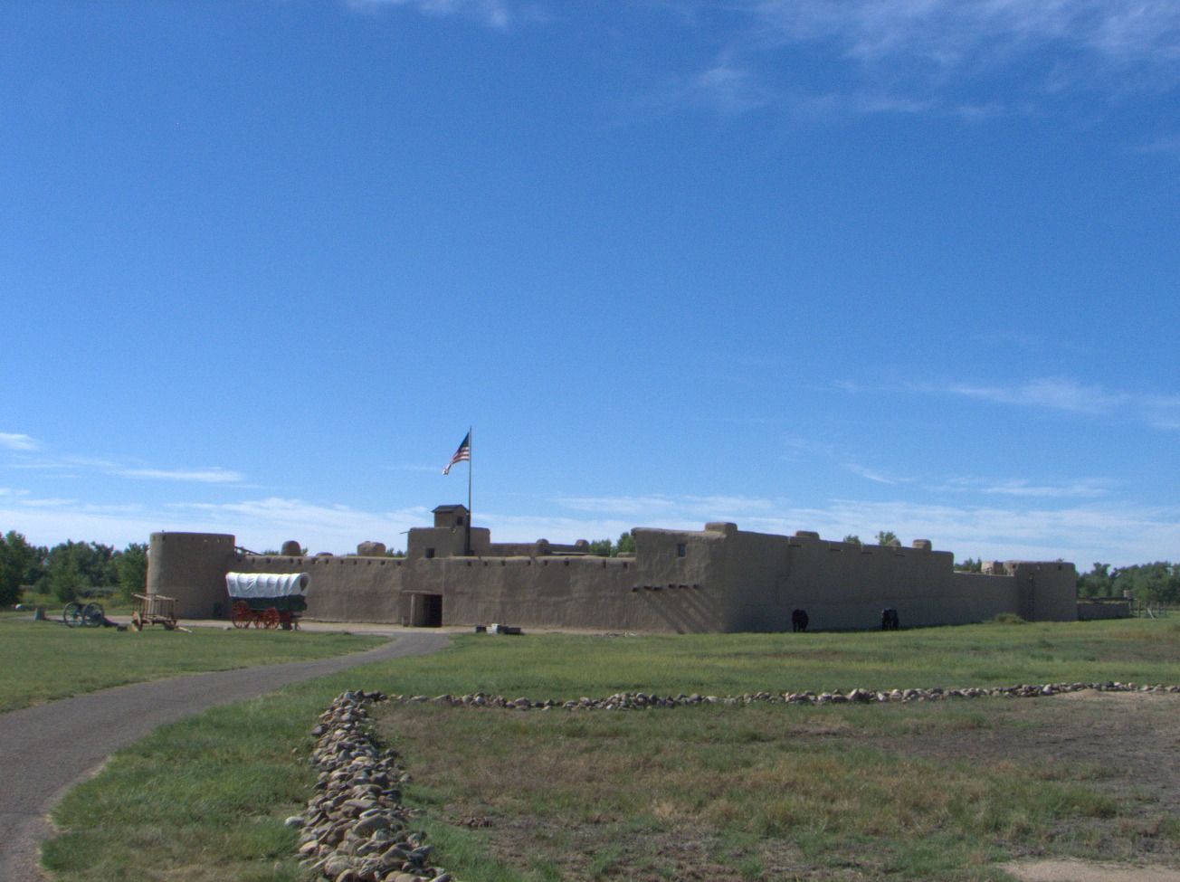
Bent's Old Fort Adobe Stockade -- This is a modern reproduction (1976), which has been immensely useful for filming TV shows portraying the period, such as James Michener's Centennial wherein it represented the adobe stockade of the American Fur Company operation at Fort John, which later became Fort Laramie in what is now Wyoming. The building seen today was constructed over the excavated site of the original fort from as-built floorplans prepared by Lieutenant James Abert in 1846 (U.S. National Park Service, Reconstructing the Castle on the Plains). (Mon 07 Sep 2015 09:51AM, Fullsize 270KB, Map) |
%20--%20Bent's%20Old%20Fort,%20CO%20--%202015-09-07%2009:52:56.L.jpg)
Conestoga Wagon -- Many of the heavier wagons used on the Santa Fe Trail were based on the famous design from the mountains of Pennsylvania. This is a modern reproduction. (The fort houses an original specimen in a dimly lit interior room.) The floorboards were concave to keep heavy freight centered. Seams in the floor, sideboards, and endgates were caulked to turn water during river crossings so cargo would stay dry: hence, the term prairie schooner. (Mon 07 Sep 2015 09:52AM, Fullsize 305KB, Map) |

Wooden Beams -- Someone (probably Bent himself) tried to burn down Bent's Old Fort sometime between 1849 (Bent's Old Fort Interpretive Staff, A Self-Guiding Tour) and 1852 (Wikipedia, Bent's Old Fort National Historic Site). As you can see, while flammable materials are structural parts of adobe construction, they are not widely exposed (Wikipedia, Adobe). It is difficult to imagine fire getting much of a start in a structure as large as this or spreading very far. Causing extensive damage would require determination, a lot of accelerant, and perhaps explosives. It may be that Bent was determined. The Arkansas River was no longer the Mexican frontier, and trade over the Santa Fe Trail had mostly shifted to the Cimmaron Route. There was a plague of cholera that occurred coincidentally during the California Gold Rush. Setting the fire may have been an attempt not only to sterilize a contaminated area but also to keep people away. (Mon 07 Sep 2015 10:25AM, Fullsize 318KB, Map) |

Weather Stripping -- Note the fur tacked to the hinge-side of the door to keep out the draft. (Mon 07 Sep 2015 10:28AM, Fullsize 284KB, Map) |
Hide Press -- It took between eight and ten buffalo hides to make a 100-pound bale. The hide press was used to compress them into as small a space as possible for transport back east. (Mon 07 Sep 2015 10:30AM, Fullsize 259KB, Map) |
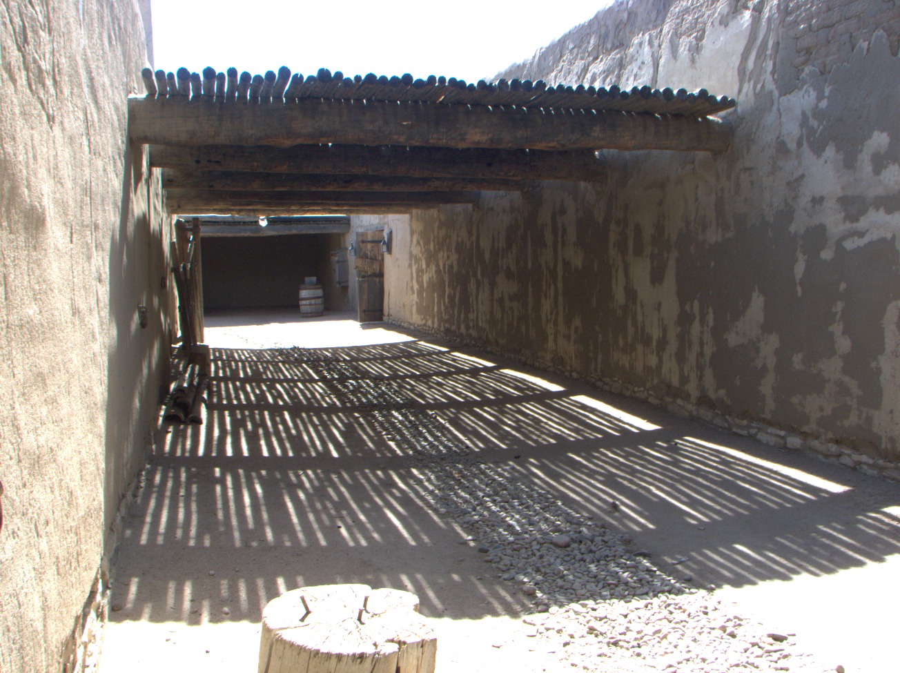
Interior Alley. (Mon 07 Sep 2015 10:32AM, Fullsize 353KB, Map) |
Corral -- This is my Georgia O'Keeffe moment. (Mon 07 Sep 2015 10:37AM, Fullsize 376KB, Map) |
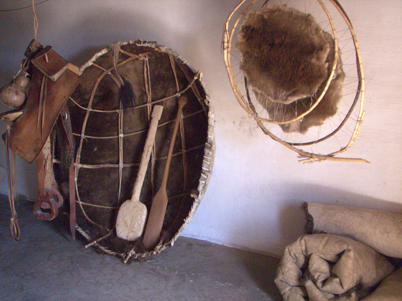
Bull Boat -- Among the eye-catching artifacts and reproductions at Bent's Old Fort is this bull boat, a coracle made of the hide of a buffalo bull. These keelless river craft were propelled by single oars, leaving little wake. Probably they were used in pairs for net fishing. Note the tail still attached to the hide. (Mon 07 Sep 2015 10:49AM, Fullsize 510KB, Map) |

Signal Cannon. (Mon 07 Sep 2015 10:53AM, Fullsize 273KB, Map) |

Stairs -- Note the rain gutters on both sides of the top step, which stick through the interior parapet wall. (Mon 07 Sep 2015 10:56AM, Fullsize 305KB, Map) |

|
5.11 Sharon Springs
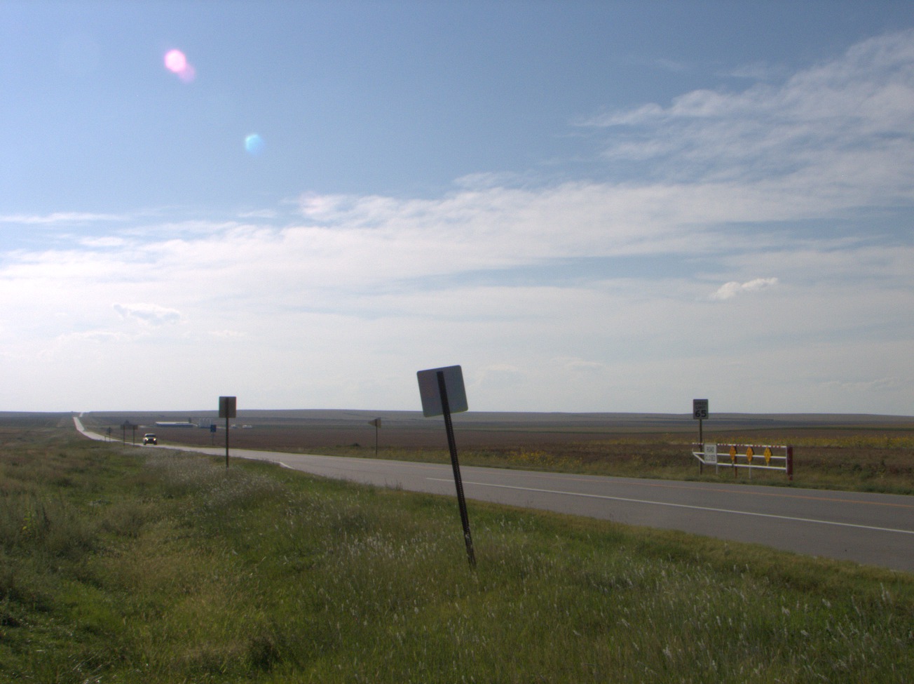
U.S. Highway 40 -- This was my view looking west from Sharon Springs, KS. (Mon 07 Sep 2015 04:30PM, Fullsize 214KB) |
5.12 Arrow Rock
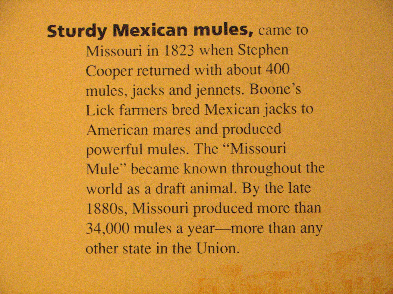
Sturdy Mexican Mules -- "came to Missouri in 1823 when Stephen Cooper returned with about 400 mules, jacks, and jennets. Boone’s Lick farmers bred Mexican jacks to American mares and produced powerful mules. The 'Missouri Mule' became known throughout the world as a draft animal. By the late 1880s, Missouri produced more than 34,000 mules a year -- more than any other state in the Union." (Wed 09 Sep 2015 11:42AM, Fullsize 566KB, Map) |
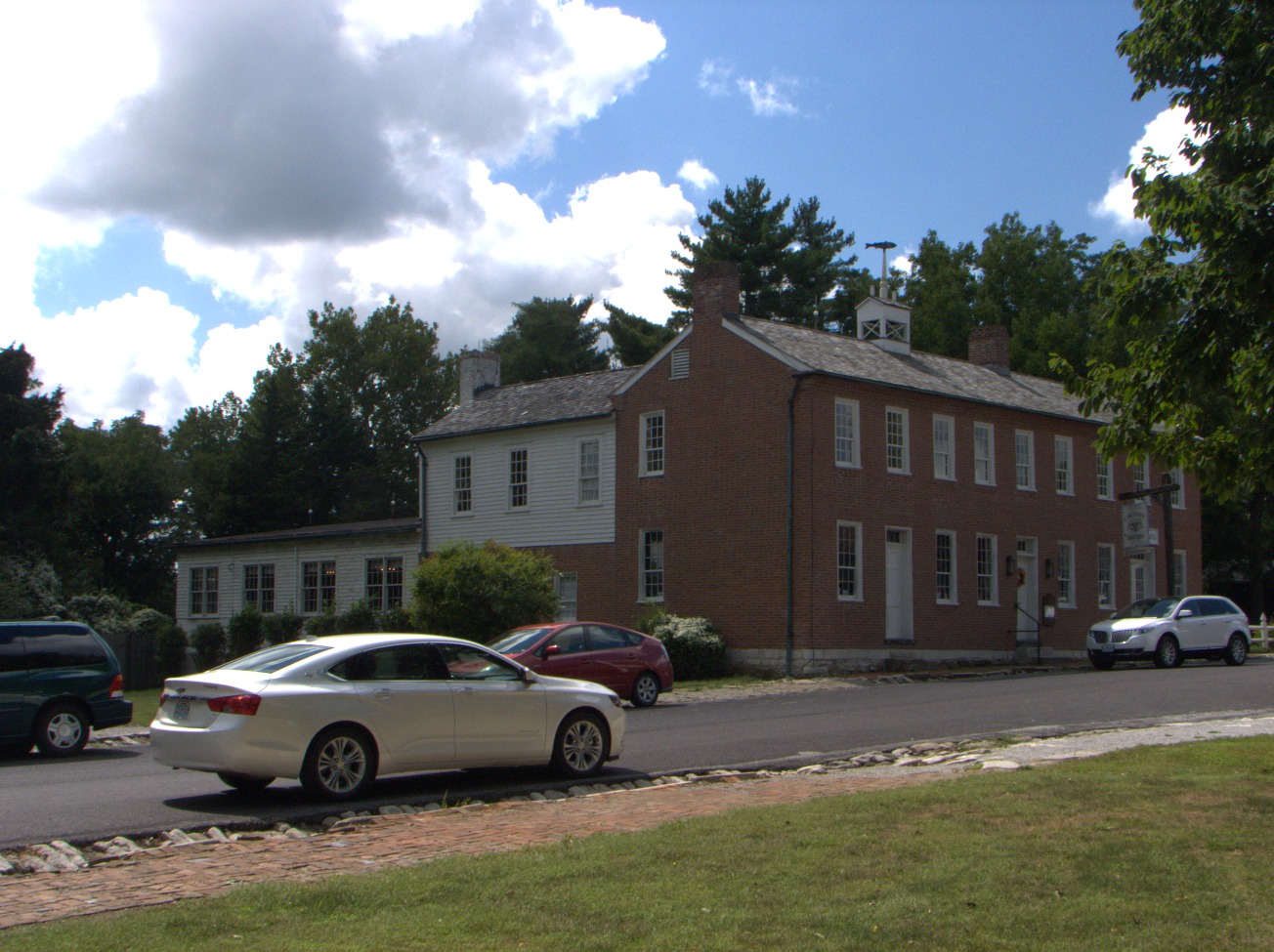
J. Huston Tavern -- This is the oldest continuously operating restaurant (1834) west of the Mississippi (Wikipedia, Arrow Rock). (Wed 09 Sep 2015 12:00PM, Fullsize 327KB, Map) |
5.13 Boonville
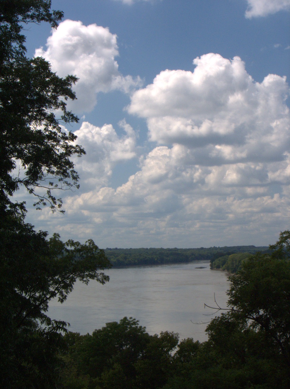
Missouri River -- upstream from Boonville, MO. (Wed 09 Sep 2015 01:05PM, Fullsize 311KB) |
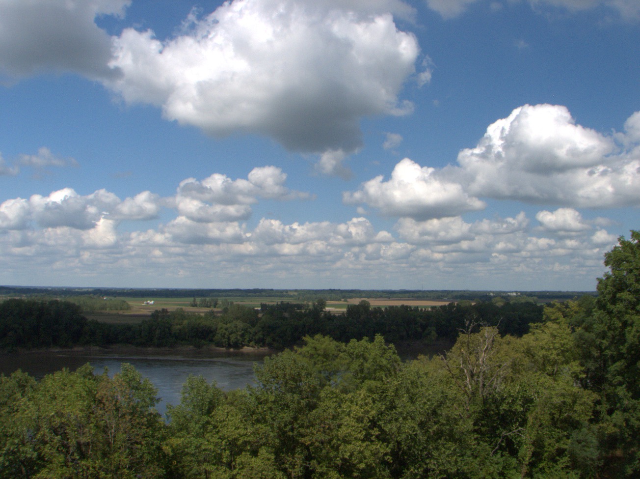
Looking north from the heights above Boonville, MO. The Missouri River is in the foreground, the Boonville Municipal Airport is beyond, and somewhere on the higher ground north of the flood plain is the site of Franklin, MO, the erstwhile jumping-off point of the Santa Fe Trail. Wed 09 Sep 2015 01:06PM, Fullsize 288KB, Map. |

Missouri River -- at Boonville, MO. (Wed 09 Sep 2015 01:12PM, Fullsize 289KB) |