Fort Larned
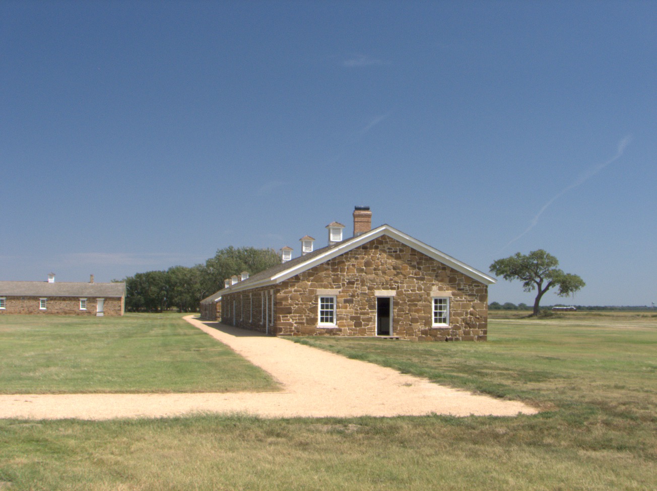
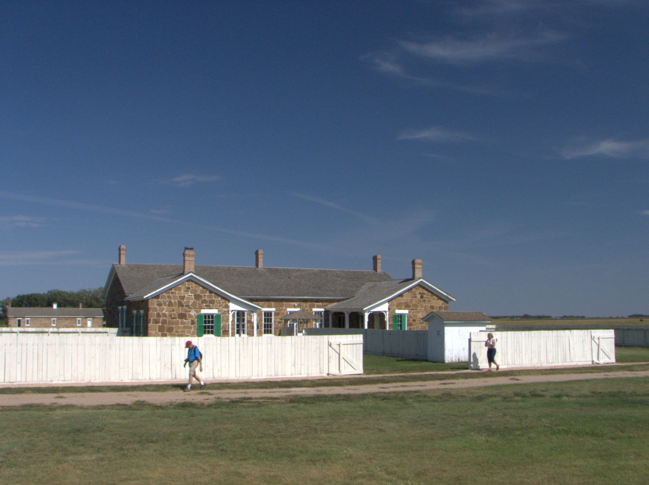
Stone Buildings -- The stone buildings at Fort Larned are original, although they have been extensively renovated in the last fifty years. They were built between 1866 and 1868 (U.S. National Park Service, Fort Larned's Buildings). Other less permanent structures have not survived. The fort was decommissioned in 1878, and the property was sold in 1884 (U.S. National Park Service, Watching the Fort). It was a ranch until 1966 when it passed back into federal ownership. The Frizell family operated the ranch after 1902 (U.S. National Park Service, Ranching Period) and did not make any irrevocable architectural changes. (Fri 04 Sep 2015 01:54PM, Fullsize 242KB, Map) |
Fort Larned was one of a series of Army outposts located near the Santa Fe Trail from which troops were dispatched to escort traffic when and where Indians threatened. Troops did not accompany travelers the whole duration (two months) and length (800 miles) of the end-to-end trip between the Missouri River and Santa Fe in New Mexico Territory (U.S. National Park Service, Santa Fe Trail) but were assigned to patrol between Fort Union and Fort Larned roughly every two weeks. They alternated between the Mountain Route and the Dry Route (Oliva).
Fine Masonry -- Workmen who quarried the stone nearby and who mortared it into place here knew their business, took pride in their handicraft, and evidently spent too much time and effort on it to please their superiors. (Fri 04 Sep 2015 01:56PM, Fullsize 349KB, Map) |
Fort Larned was located near the eastern junction of the Dry and Mountain Routes of the Santa Fe Trail.
Today, the site has been renovated and is open to the historically inquisitive. It houses a collection of antiques and period-correct reproductions, including an Army bunkhouse complete with uniforms, tack, and supplies. There is also a rare specimen of an original Conestoga wagon.
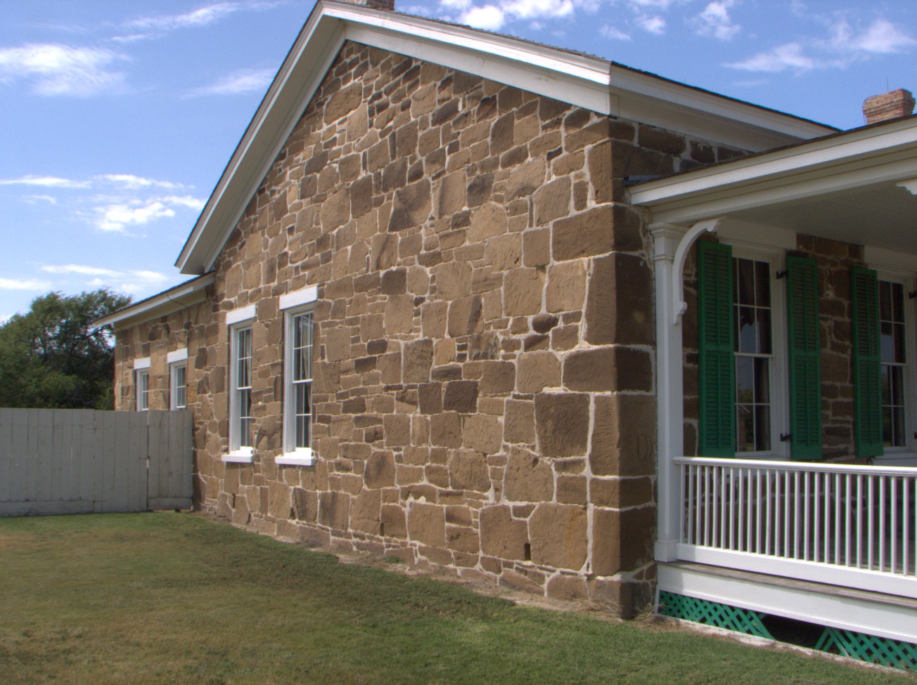
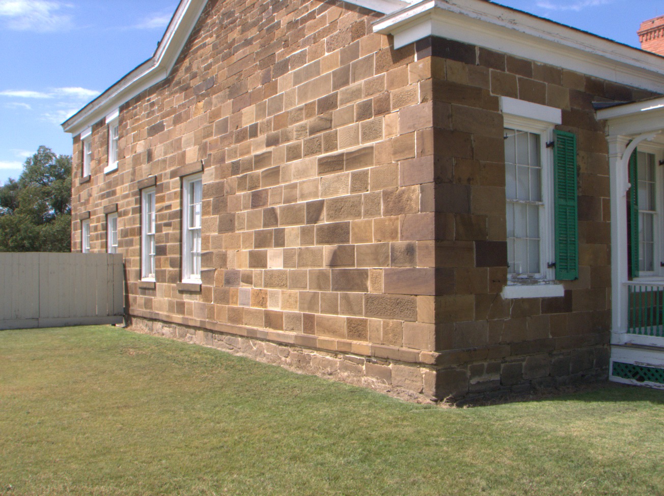
Rough Masonry -- You can easily imagine that those in charge concluded there was too much waste of material and time going on and commanded a more pragmatic standard of construction for the remaining buildings. (Fri 04 Sep 2015 01:57PM, Fullsize 327KB, Map) |
In the spring of 1867, General Winfield Scott Hancock , who had been wounded during Pickett's Charge at Gettysburg in 1863, led a large detachment of troops from Fort Larned to sack a deserted Cheyenne and Sioux village nearby. All the families in the village had fled at the Army's approach, fearing a recurrence of the Sand Creek Massacre. The presence of the Army on the High Plains provoked a summer-long series of battles known as Hancock's War (U.S. National Park Service, Hancock's War). Details of the inconclusive campaign were circulated in the press by General George Armstrong Custer while he was on disciplinary suspension from Hancock's outfit (Hart). Nine years later, Custer was dead, and, four years after that, Hancock was the Democratic Presidential Candidate.
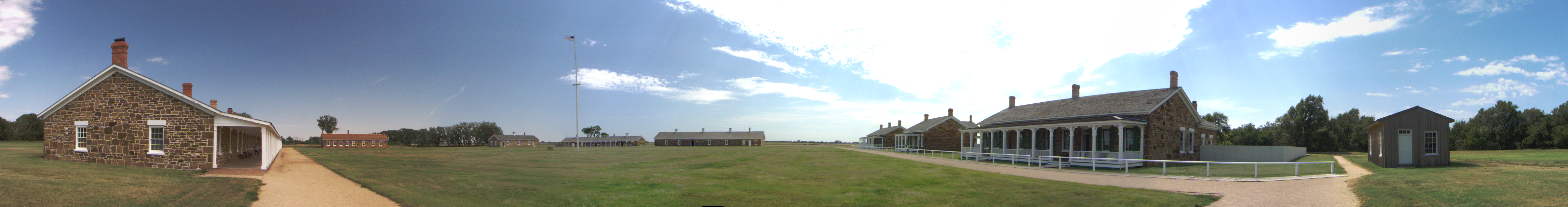
Panorama -- This thumbnail is number six out of ten that were stitched together using the Hugin utility program. Please click on the thumbnail to see a 180° panorama of the quadrangle. (Fri 04 Sep 2015 02:01PM, Fullsize 5.2MB, Map) |
Because it was politically incorrect, not to say infeasible, to station segregated units of black U.S. Army soldiers in states comprising the former Confederacy during Reconstruction, these were instead deployed in the West where they were engaged during the Indian Wars. These troops adopted the name Buffalo Soldiers. Company A of the 10th Cavalry was billeted at Fort Larned from 1867 to 1869 (U.S. National Park Service, 10th Cavalry at Fort Larned).
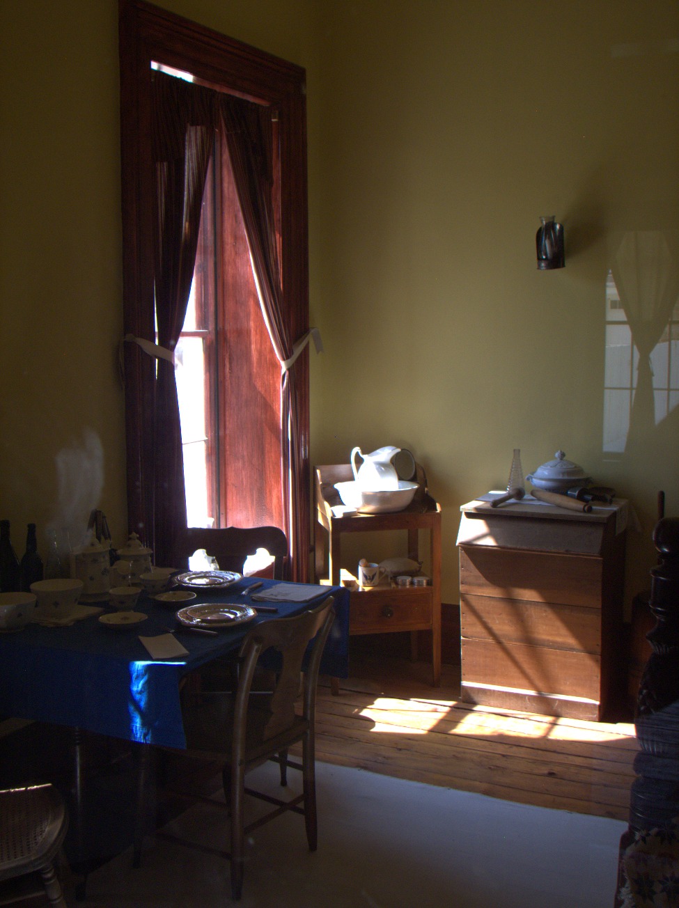
Interior -- Officers and their families lived in comparative comfort. (Fri 04 Sep 2015 03:36PM, Fullsize 228KB, Map) |
Wells and Privies -- Each duplex at the west side of the quadrangle had its own well and privy. They seem awfully close together by today's standards (Muruka). (Fri 04 Sep 2015 03:47PM, Fullsize 258KB, Map) |